
Service Cartographique du Ministère des Colonies (sold)

Service Cartographique du Ministère des Colonies (c. 1910 - 1962) was the Belgian colonial cartographic service that produced maps of Belgium's colonial empire, concentrated in central Africa, in the early-mid 20th century. It was formed during the Belgian state's assuming administration over the earlier Congo Free State and carried out important detailed surveys of the Belgian portion of central Africa, which came to include Rwanda and Burundi after the First World War. The Service was most active in the Interwar period and again after the disruptions of the Second World War, producing both topographic maps but also thematic maps on linguistic and ethnic groups, climate, economics, and medical sciecnes.
Height of Belgian Colonialism.
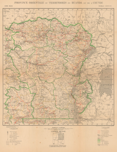
Province orientale et territoires du Ruanda et de l'Urundi.
sold
- Digital Map Information
- Suitable for large format printing
- File Size: 43.03 MB
- File Type: ZIP / TIFF
- ICC color profile embedded
- Delivered instantly via download link
This is a 1930 Belgian Ministère des Colonies Service Cartographique map of Central Africa covering much of the interior continent. It was produced when Belgium's colonial footprint in Africa was at its height, covering most of the territory seen here. (more details)