
Shields, F. W. (sold)

J. B. Shields (fl. c. 1850 - 1854) was a Boston based book and map publisher active in the mid-19th century. From their offices at 19 Hanover Street, Boston, the J. B. Shields firm published numerous maps and books, most of which were of a technical nature.
Stunning case map of Boston and vicinity.
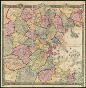
Map of the City and Vicinity of Boston, Massachusetts.
sold
- Digital Map Information
- Suitable for large format printing
- DPI: 300
- File Size: 0.65 MB
- File Type: ZIP / TIFF
- ICC color profile embedded
- Delivered instantly via download link
This is a stunning large format first edition 1852 case map of Boston, Massachusetts, and vicinity. Centered on Boston, the map covers from Danvers to Hingham, and from Weston to Massachusetts Bay. Towns are coded in bright original color. The map is incredibly ... (more details)

An extremely scarce and dramatic 1852 wall map of Boston, Massachusetts and vicinity. Depicts the greater Boston area from Dover in the southwest to part of Concord in the northwest to Hingham southeast and to Danvers northeast. Includes all of Brookline, Newton ... (more details)