
Smith, Robert Pearsall
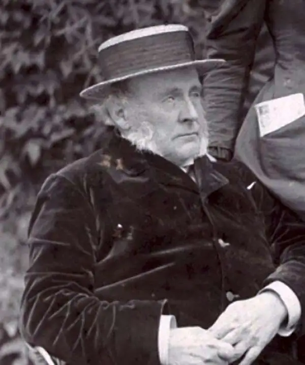
Robert Pearsall Smith (February 1, 1827 - April 17, 1898) was an American map maker active in Philadelphia from the middle to late 19th century. Smith was born to a Quaker family in Philadelphia, all librarians and publishers. Robert Pearsall originally ran a law bookstore at 19 James Street, Philadelphia. It was not until 1846 that Smith began producing maps in collaboration with this father, John Jay Smith (1798 - 1881), and brother, Lloyd P. Smith (1822 - 1886). One year earlier, in 1845, John Jay, then librarian at the Library Company of Philadelphia and Loganian Library, acquired the American rights to the anastatic process of transfer lithography. In February of 1846 he and his two sons founded the Anastatic Office, a printing concern based on the anastatic process located at 317 Market Street, Philadelphia. The Anastatic Office produced numerous copies and reissues of historic documents and maps from the Library Company's collection before being dissolved in 1847. In the same year Robert Pearsall opened a printing establishment under his own name at 144 Chestnut Street. In 1858, he joined forced with the Swiss-American engraver Frederick Bourquin (1808 - 1897) under the imprint 'F. Bourquin and Company' (602 Chestnut Street). Smith retired suddenly and inexplicably from the printing business around 1865. Smith was also deeply religious, a lay leader in the Holiness Movement in the United States and the Higher Life Movement in Great Britain. In 1873, Smith and his wife, Hannah Tatum Whitall (1832 - 1911), crossed the Atlantic to preach in England, Germany and Switzerland. They returned in 1875, preaching in Brighton, where Smith supposedly had an affair with an American writer. In, 1888, his entire family moved to England.
On the cover of Ristow's 'Maps and Mapmakers.'
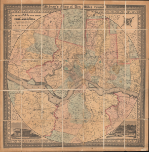
Map of the Circuit of Ten Miles Around the City of Philadelphia With the names of Villages, Roads, Milles, Property Owner, Taverns, etc. / Sidney's Map of Ten Miles round.
$3,800.00
Acquire
- Digital Map Information
- Suitable for large format printing
- File Size: 35.64 MB
- File Type: ZIP / TIFF
- ICC color profile embedded
- Delivered instantly via download link
This is an attractive example of J. C. Sidney's 1847 map of Philadelphia, covering the city and its vicinity 'Ten Miles round'. Smith, the publisher, considered this one of the 'most successful of his maps'. Water Ristow, in American Maps and Mapmakers, placed this map on the cover, devoted a full-page illustration to it, and included several pages of text, underscoring its significance as an example of mid-19th-century American map publishing. Indeed, its producers were a who's who of Philadelphia map publishing: Robert Persall Smith, Norman Friend, Augustus Köllner, Peter Steven Duval, and James Charles Sidney. (more details)
Pennsylvania Anthracite Boom - driving the Industrial Revolution.
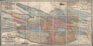
Map of the First and Second Anthracite Coal Fields in Pennsylvania; embracing Schuylkill County and parts of Carbon, Luzerne, Columbia, Northumberland, Dauphin and Lebanon Counties.
$3,500.00
Acquire
- Digital Map Information
- Suitable for large format printing
- DPI: 600
- File Size: 211.86 MB
- File Type: ZIP / TIFF
- ICC color profile embedded
- Delivered instantly via download link
This is a large-scale 1849 Peter W. Sheafer and Robert P. Smith map of northeastern Pennsylvania illustrating the peak of the Anthracite Coal Boom - one of the driving factors of American industrial development in the 19th century. (more details)
Poughkeepsie and Hyde Park.
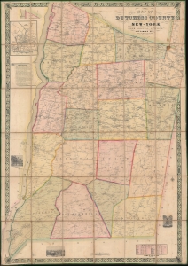
Map of Dutchess County New-York From Original Surveys.
$2,200.00
Acquire
- Digital Map Information
- Suitable for large format printing
- DPI: 600
- File Size: 242.51 MB
- File Type: ZIP / TIFF
- ICC color profile embedded
- Delivered instantly via download link
This is an 1850 James C. Sidney wall map of Dutchess County, New York, published a year after the Hudson River Railroad reached Poughkeepsie and a year before it reached Albany. The map marks a definitive moment in Dutchess County history, when the railroad opened the region - for the first time, to large-scale commerce and industry. This is, consequently, the largest and best early map of Dutchess County to appear before the American Civil War (1861 - 1865). This is moreover, an exceptional example of an early-American county map, the precursor of later town and county maps by Beers, Walling, and others. (more details)
Estates of New York's 'Aristocracy'.
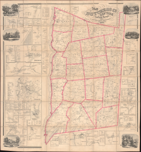
Map of Dutchess Co. New York from Actual Surveys.
$3,500.00
Acquire
- Digital Map Information
- Suitable for large format printing
- DPI: 600
- File Size: 205.94 MB
- File Type: ZIP / TIFF
- ICC color profile embedded
- Delivered instantly via download link
This is John Gillette's 1858 very large-format case map of Dutchess County, New York. It is notable, among other features, for including the estates of the leading families of New York, including the father and grandfather of future president Franklin D. Roosevelt. (more details)
Greatest map of New Jersey.
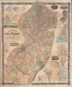
Topographical map of the State of New Jersey together with the vicinities of New York and Philadelphia, and with most of the state of Delaware from the State Geological Survey and the U.S. Coast Survey, and from surveys by G. Morgan Hopkins, civil engineer.
$4,500.00
Acquire
- Digital Map Information
- Suitable for large format printing
- File Size: 600.38 MB
- File Type: ZIP / TIFF
- ICC color profile embedded
- Delivered instantly via download link
Magnificently detailed, visually stunning, and monumentally proportioned, this is William Kitchell's seminal 1861 wall map of New Jersey. This is the largest and most detailed map of New Jersey printed in the 19th century. (more details)