
Stebbins, Henry Searls (sold)

Henry Searls Stebbins (November 16, 1835 - June 22, 1898) was an Ohio based map publisher active in the second half of the 19th century. Stebbins was bornin Albany, New York, son of Rowland Stebbins. He studied at the 'State Normal College'. He worked as a School Commissioner in Erie County, New York, for six years. In 1867 he published an 'Atlas of Ohio'. He was involved in the book trade in Toledo, Ohio, from 1868 to 1872, and in 1874 resumed the map publishing business, continuing in that business in Chicago until 1892, when he retired from active business life.
Ephemeral configuration of the Dakota Territory.
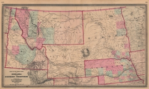
Nebraska and Northern Territories.
sold
- Digital Map Information
- Suitable for large format printing
- File Size: 57.39 MB
- File Type: ZIP / TIFF
- ICC color profile embedded
- Delivered instantly via download link
This is an 1868 Henry Stebbins and H. H. Lloyd map of Nebraska and the Northern Territories exhibiting an ephemeral configuration of the northern plains. Nebraska, Idaho, and Montana are recognizable, but 'Dakota' contains North and South Dakota and an unlabeled Wyoming is identified simply as 'Unexplored Territory'. (more details)
Wyoming just after it became a territory.
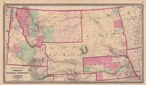
Nebraska and Northern Territories.
sold
- Digital Map Information
- Suitable for large format printing
- File Size: 52.02 MB
- File Type: ZIP / TIFF
- ICC color profile embedded
- Delivered instantly via download link
This is an 1869 Henry Stebbins and H. H. Lloyd map of Nebraska and the Northern Territories exhibiting an ephemeral configuration of the northern plains. Nebraska, Idaho, and Montana are recognizable, but 'Dakota' contains North and South Dakota. Wyoming is labeled for the first time and still includes the previous identifier 'Unexplored Territory.'
Collector William Resor points out that in addition to adding the placename Wyoming, this state of the map is also important for showing the Union Pacific Railroad complete beyond Bridger Pass: the first state of the map, which did not name Wyoming, had the Union Pacific complete only to the Laramie River. (more details)
Collector William Resor points out that in addition to adding the placename Wyoming, this state of the map is also important for showing the Union Pacific Railroad complete beyond Bridger Pass: the first state of the map, which did not name Wyoming, had the Union Pacific complete only to the Laramie River. (more details)