
Survey of Israel (sold)

The Survey of Israel (1949 - present), known after 1949 as the Department of Surveys-Israel (מַחלָקָה המדידות-ישראל) and since 1988 known as the Israel Mapping Center (המרכז למיפוי ישראל), is the successor of the Survey Department of Palestine, established by the British Mandate authorities in 1920. Under the British Mandate, the Survey was initially responsible for undertaking cadastral surveys and adjudicating land disputes, working with vague Ottoman-era records which were unreliable in any case due to property owners seeking to reduce their tax burden. When Jewish settlers began arriving in large numbers at the turn of the 20th century, they were often sold land from these ill-defined plots without any record of sale. Thus, the Survey was responsible for the laborious task of first producing a precise cadaster and then resoling the resulting disputes. From 1940, it shifted focus to drawing topographical maps of the Mandate's territory, a project that carried over into the post-1949 period. Under the United Nations plan for the partition of Palestine, the Survey was also meant to be divided into Jewish and Arab sections, but in effect most of the Survey's workers and records ended up in Tel Aviv. In the post-statehood era, the Survey continued topographical surveys and cadastral work in remote areas and in recent decades has adopted cutting-edge technologies such as geoinformatics.
Israel's Ellis Island.
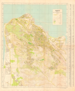
An impressive, large-format Hebrew-language survey map of Haifa, produced in 1957 by the Survey of Israel. (more details)
Israel's Growing Travel and Tourism Industry.
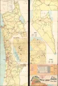
מפת כרטא לכבישי ישראל לנופש ולמטייל / [Carta Map of Israel Roads for Vacationers and Travelers].
sold
A colorful 1966 road map of Israel, prepared by the firm Carta, based in Jerusalem. It reflects the development of Israel's road network, domestic tourism, and consumer economy in the decades after statehood. (more details)
Safe and secure sightseeing after the Six-Day War.
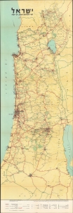
A scarce 1969 Zionist road map of Israel, produced by the Jerusalem firm Carta. Designed like a strip map, mimicking the elongated shape of Israel, the map provides information for motorists and travelers while also reflecting (and endorsing) the post-1967 / Six Day War borders of Israel. (more details)
Celebrating 30 Years of the Nation of Israel
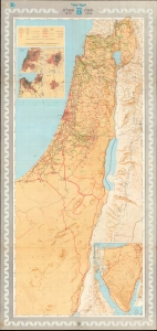
ישראל תש'ח-תשל'ח 1948-1978 / [Israel 5708 - 5738 1948 - 1978]. / מתש'ח לתשל'ח - מפת הישגים [5708 - 5738 - A Map of Achievements].
sold
An impressive Hebrew-language map of Israel, published in 1978 by the Survey of Israel to celebrate the 30th anniversary of the nation's founding. (more details)