
Vadian, Joachim von Watte (sold)
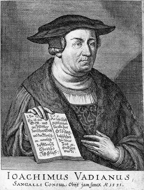
Vadian, born Joachim von Watte (November 29 1484 - April 6, 1551), was a Swiss doctor, humanist, and geographer. He was born to a prominent merchant family in St. Gallen, Switzerland, but studied broadly at the University of Vienna, becoming a prolific humanist author and debater. There he became a professor, and went on to study medicine, the natural sciences, and geography. He rose to the position of Dean in 1516 and earned his doctorate. (He was not solely a creature of the mind; in 1518, he executed the first documented ascent of Lucerne's Pilatus mountain.) Thereafter, he returned to St. Gallen to become city physician. With the advent of the Reformation, he became an active Protestant (having married the daughter of a prominent Anabaptist). He became friends with reformist Ulrich Zwingli, who introduced Vadian to the textual underpinnings of his new faith.
When his father, by then a member of the city council, died in 1520, von Watte succeeded his father in that role. Thus, he was in a position to advocate for the Protestant cause from a position of power. His election as city mayor in 1526 lent him the authority to lead the conversion of St. Gallen to Protestantism; he managed to retain his position even after the Catholic victories in the Second War of Kappel.
Vadian was a prolific writer; his student output was largely poetry. Later he would produce several theological texts, but he also produced histories and geographical works, most notably his Epitome trium terrae partium Asiae, Africae et Europae. He was also a voracious book collector: upon his death his copious library was donated to his city, providing the core of the Cantonal Library of St. Gallen, named after its illustrious first donor.
When his father, by then a member of the city council, died in 1520, von Watte succeeded his father in that role. Thus, he was in a position to advocate for the Protestant cause from a position of power. His election as city mayor in 1526 lent him the authority to lead the conversion of St. Gallen to Protestantism; he managed to retain his position even after the Catholic victories in the Second War of Kappel.
Vadian was a prolific writer; his student output was largely poetry. Later he would produce several theological texts, but he also produced histories and geographical works, most notably his Epitome trium terrae partium Asiae, Africae et Europae. He was also a voracious book collector: upon his death his copious library was donated to his city, providing the core of the Cantonal Library of St. Gallen, named after its illustrious first donor.
Discovery Era World Map.
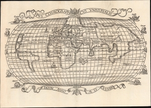
Typus Cosmographicus Universalis.
sold
- Digital Map Information
- Suitable for large format printing
- Full resolution TIFF file
- ICC color profile embedded
- Delivered instantly via download link
This is Joachim Vadian's rare 1534 woodcut map of the world, combining a largely Ptolemaic formulation of Europe and Asia with what was a modern depiction of Africa and the New World. It is one of the earliest maps to name America. While largely derived from the map Sebastian Münster prepared for Simon Grynaeus in 1532, it is in many ways a better representation of Münster's source, the 1507 map of Martin Waldseemüller. (more details)