
Wuhrer, Frédéric Louis Charles (sold)

Frédéric Louis Charles Wuhrer (1844 - 1925) was a French cartographer, engraver, and artist. He lived in the town of Buc, France, where he purchased the former Town Hall. Wuhrer is better known as a landscape artist, with a strong record at auctions. Little is known of his engraving work, but the Bibliothèque nationale de France has over one hundred pieces in their collection attributed to his name.
Missionary life just before the Boxer Rebellion.
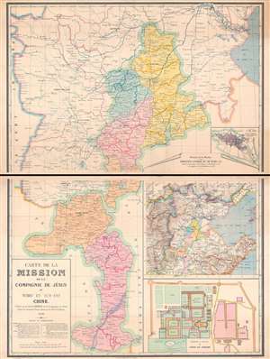
Carte de la Mission de la Compagnie de Jesus au Tcheu Ly Sud-Est Chine.
sold
- Digital Map Information
- Suitable for large format printing
- Full resolution TIFF file
- ICC color profile embedded
- Delivered instantly via download link
This is a rare 1890 Carrez map of western Shandong and southern Hebei, China, illustrating missionary activity in the region just a few years prior to the Boxer Rebellion (1899 - 1901). Coverage extends roughly from Tianjin (Tientsin), located in the upper right, south to roughly Zaozhuang. The map details the oddly shaped Apostolic Vicariate of Tché-Ly du Sud- East, occupying part of western Shandong and southern Hebei. The map is further subdivided into missionary districts, with coded icons representing the locations of churches and their status. In the lower right, there is a smaller map illustrating the general vicinity, and a large inset of the large fortified mission at Tchang Kia Tchouang (Chiang Kia-Chuang). (more details)
Georgia and South Carolina Coasts.
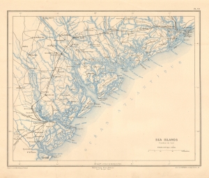
Sea Islands (Caroline due Sud).
sold
- Digital Map Information
- Suitable for large format printing
- File Size: 7.96 MB
- File Type: ZIP / TIFF
- ICC color profile embedded
- Delivered instantly via download link
This is a striking 1890 Dumas Vorzet map of the coasts of South Carolina and Georgia, issued to illustrate the scarce atlas volume of the French edition of Price Philippe d'Orléans' Histoire de la Guerre Civile en Amérique. (more details)
The Bloodiest Day in U.S. Military History.
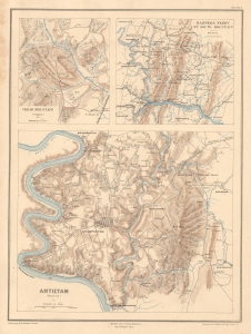
Cedar Mountain (Virginie). Harpers Ferry et South Mountain. Antietam (Maryland).
sold
- Digital Map Information
- Suitable for large format printing
- Full resolution TIFF file
- ICC color profile embedded
- Delivered instantly via download link
This is Ernest Dumas-Vorzet's map of the 1862 Civil War Battles of Cedar Mountain, Harpers Ferry, and Antietam, issued to illustrate the 1890 book Histoire de la Guerre Civile en Amérique. (more details)
Crucible of the Civil War.
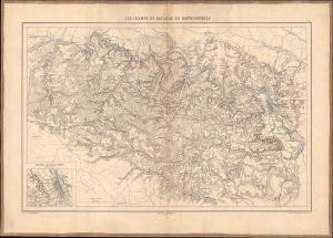
Les champs de bataille du Rappahannock.
sold
- Digital Map Information
- Suitable for large format printing
- File Size: 26.28 MB
- File Type: ZIP / TIFF
- ICC color profile embedded
- Delivered instantly via download link
This 1890 Dumas Vorzet map displays eastern Virginia south of the Rappahannock River, the site of several important battles in the U.S. Civil War. It appeared in the scarce 1890 atlas volume of the French edition of Philippe d'Orléans' Histoire de la Guerre Civile en Amérique. (more details)
Capturing the Crescent City.
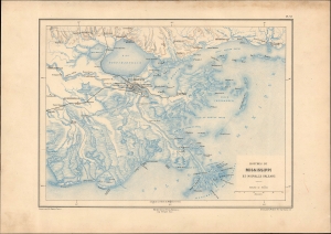
Bouches du Mississippi et Nouvelle Orleans.
sold
- Digital Map Information
- Suitable for large format printing
- File Size: 13.43 MB
- File Type: ZIP / TIFF
- ICC color profile embedded
- Delivered instantly via download link
A remarkable map of the Mississippi River Delta, New Orleans, and environs, prepared in 1890 by Ernest Dumas-Vorzet. It appeared in the scarce 1890 atlas volume of the French edition of Philippe d'Orléans' Histoire de la Guerre Civile en Amérique. (more details)
A French Prince in the American Civil War.
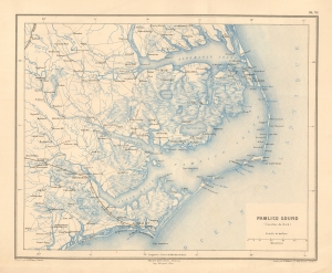
Pamlico Sound (Caroline du Nord).
sold
- Digital Map Information
- Suitable for large format printing
- File Size: 9.12 MB
- File Type: ZIP / TIFF
- ICC color profile embedded
- Delivered instantly via download link
This is a striking 1890 Dumas Vorzet map of the Pamlico Sound and Albemarle Sound, eastern North Carolina, issued to illustrate the scarce atlas volume of the French edition of the Prince Philippe d'Orléans' Histoire de la Guerre Civile en Amérique. (more details)
Emergence of 'the Grey Ghost'
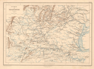
Environs de Warrenton (Virginie).
sold
- Digital Map Information
- Suitable for large format printing
- File Size: 7.95 MB
- File Type: ZIP / TIFF
- ICC color profile embedded
- Delivered instantly via download link
This is Ernest Dumas-Vorzet's 1890 map of Warrenton, Virginia and environs, prepared for his Histoire de la Guerre Civile en Amérique. It relates to the 1863 American Civil War (1861 - 1865) Warrenton Junction Raid, one of the first significant actions of 'the Gray Ghost', Confederate commander John S. Mosby and his eponymous Mosby’s Rangers. (more details)
Georgia and South Carolina Coasts.
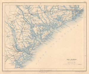
Sea Islands (Caroline due Sud).
sold
- Digital Map Information
- Suitable for large format printing
- File Size: 7.55 MB
- File Type: ZIP / TIFF
- ICC color profile embedded
- Delivered instantly via download link
This is a striking 1890 Dumas Vorzet map of the coasts of South Carolina and Georgia, issued to illustrate the scarce atlas volume of the French edition of Price Philippe d'Orléans' Histoire de la Guerre Civile en Amérique. (more details)
A House Divided...
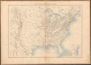
Carte générale du théâtre de la guerre.
sold
- Digital Map Information
- Suitable for large format printing
- Full resolution TIFF file
- ICC color profile embedded
- Delivered instantly via download link
This is Ernest Dumas-Vorzet's 1890 map of the United States, prepared for Histoire de la Guerre Civile en Amérique. It was the first map in the atlas volume accompanying the book. (more details)
An Imperiled Capital.
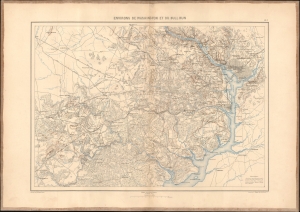
Environs de Washington et du Bull Run.
sold
- Digital Map Information
- Suitable for large format printing
- File Size: 21.94 MB
- File Type: ZIP / TIFF
- ICC color profile embedded
- Delivered instantly via download link
This is an 1890 Dumas Vorzet map of Washington, D.C., and its environs in eastern Virginia, the scene for multiple important battles during the American Civil War (1861 - 1865), issued as part of the scarce atlas volume of the French edition of Philippe d'Orléans' Histoire de la Guerre Civile en Amérique. (more details)