
Cortesi, Saturnino (sold)

Saturnino Cortesi (fl. c. 1900 - 1925) was a Uruguayan geographer active in the late 19th and early 20th century. In 1903 he, along with Anibal Méndez, was commissioned by the president of Uruguay, José Batlle y Ordoñez, to compile a large-scale official national map of Uruguay. He also issued a large wall map of the department of Montevideo in 1906. In addition, he published educational geographical texts in 1905 and 1908.
Official plan of Montevideo during its golden age.
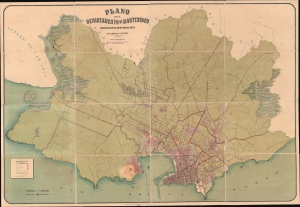
Plano del Departamento de Montevideo construido con los datos mas recientes.
sold
- Digital Map Information
- Suitable for large format printing
- Full resolution TIFF file
- ICC color profile embedded
- Delivered instantly via download link
This extraordinary large-scale 1906 Saturnino Cortesi chromolithograph map of Montevideo illustrates the Uruguayan capital at the height of its early 20th century golden age. Cortesi's work is significant as it provides insights into Montevideo's development and the nation's geographical layout during a time of rapid growth and urbanization. Coming out of the 19th century, Montevideo enjoyed sustained economic prosperity, widespread immigration, and the progressive José Batlle y Ordoñez government led to explosive urban and cultural growth. This official government plan was intended to guide the development of new barrios, boulevards, grand squares, monumental edifices, and modern infrastructure, all of which are detailed. (more details)