
Approved Atlas and Maps Ltd. (sold)

Approved Atlas and Maps Ltd. (fl. c. 1948 - 1951) was a map and atlas publishing firm based in Miami, Florida. The firm produced several plat-book atlases of Miami as well as at least one separately issued city plan of Miami and Coral Gables.
The Orange Bowl and city parks.
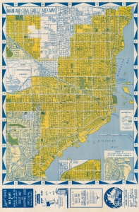
This is a striking 1949 'Approved Atlas and Maps' city map of Miami and Coral Gables, Florida. Streets are labeled throughout, along with the Florida East Coast Railroad. Golf courses, city parks, and the Orange Bowl are marked. Two insets focus on the West End of Miami and southern Coral Gables. Ads below the bottom border promote the Miami, North Dade County, and Coral Gables Chambers of Commerce. More advertisements and street indexes of Miami and Coral Gables occupy the verso. (more details)
Orange Bowl and city parks.
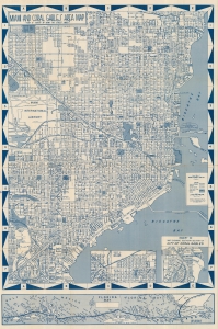
This is a striking 1949 'Approved Atlas and Maps' city map of Miami and Coral Gables, Florida. (more details)
The Orange Bowl, city parks, and the Florida Keys.
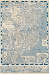
This is a striking cyan-toned c. 1950 'Approved Atlas and Maps' city map of Miami and Coral Gables, Florida. Streets are labeled throughout, along with the Florida East Coast Railroad. Golf courses, city parks, and the Orange Bowl are marked. Two insets focus on the West End of Miami and southern Coral Gables. A smaller map along the bottom border illustrates the Overseas Highway from Key Largo to Key West. (more details)