
Askevold, Anders Madsen (sold)

Anders Madsen Askevold (January 16, 1842 - August 16, 1901) was a Norwegian map publisher based in Chicago Illinois in the late 19th century. Askevold immigrated from Valkryien, Bergen, Norway to Quebec on May 25 1968. From there he made his way to Chicago where he established the firm 'Merchant's Lithographers' in 1870. This firm was unfortunately destroyed just one year later in 1871 by the Great Chicago Fire. We have found no examples of cartographic work printed by Anders during this period, but the Library of Congress does mention the firm as a publisher of panoramic maps. Afterwards he partnered with Peter (Pierre) Roy (1840 - ????), to found the Chicago Map Establishment located at 67 Ashland Block, Chicago. After 1875 or Askevold may have acquired Roy's shares in the firm as from this point on he is listed sole proprietor. This firm published at least 10 different maps, most of which focused on Chicago and Oregon. The connection here is unclear. He returned to Norway from 1880 to 1888, where he printed at least one map of Bergen Norway, before returning to Chicago and resuming a publishing career in April of 1889. He remained in business until about 1898, the date of his last known publication.
Scarce pocket map of Chicago.
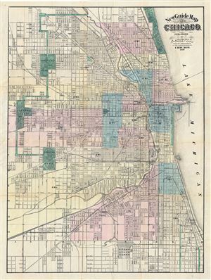
New Guide Map of Chicago. Abraham Lincoln Presidential Library, GZ896 C53 (1875) A834.
sold
- Digital Map Information
- Suitable for large format printing
- File Size: 21.78 MB
- File Type: ZIP / TIFF
- ICC color profile embedded
- Delivered instantly via download link
An extremely rare 1876 pocket map of Chicago, Illinois by the Anders M. Askevold. This Chicago published map covers from Central Park in the west to Lack Michigan in the east, and from Lincoln Park in the north to Union Stock Yards in the south. City wards are ... (more details)
'... one of the first and best maps that show both Oregon and Washington together, in a large scale, published as a separate' - Rumsey
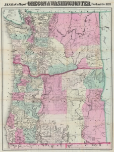
J.K. Gill and Cos. Map of Oregon and Washington Ter.
sold
- Digital Map Information
- Suitable for large format printing
- Full resolution TIFF file
- ICC color profile embedded
- Delivered instantly via download link
This is the 1878 Robert Habersham and John Gill map of Oregon and Washington Territory. It was issued during Washington's early push for statehood. According to David Rumsey, 'this is one of the first and best maps that show both Oregon and Washington together, in a large scale, published as a separate'. The present example has provenance connecting it to Jacob Kamm, co-founder of the Oregon Steam Navigation Company. (more details)