
Chappe d'Auteroche, Jean-Baptiste (sold)
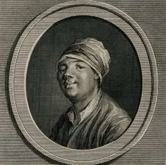
Jean-Baptiste Chappe d'Auteroche (March 23, 1722 – August 1, 1769) was a French astronomer and explorer. He was born to a noble family of Auvergne, France. He entered the priesthood where is was able to dedicated himself to the study of Astronomy. he was appointed assistant Astronomer at the Royal Observatory and, on January 14, 1758, was admitted to the Paris Académie des Sciences. Auteroche is best known for his observation of the Transit of Venus in 1761 and in 1769. The scientific world at the time recognized an unprecedented opportunity to determine the size of the Solar System using exact observations of the Transits of Venus in 1761 and again in 1769. By applying the calculations associated with these transits in the light of Kepler's Laws of Planetary Motion, it was possible to determine for the first time the distance between planets. Auteroche's first expedition led him to Siberia, where is observed the 1761 transit from Tobolsk. He observed the second transit, in 1769, from Baja California in Mexico. On the return voyage the crew of Auteroche's ship were struck by Yellow Fever. With the exceptional of a single passenger, everyone on board, including Auteroche, died. That survivor managed to salvage Auteroche's notes and return them to the Académie des Sciences in Paris. Auteroche's notes and journals were published posthumously by Cesar Cassini de Thury.
A fine early map of Kamchatka.
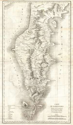
Carte du Kamtchatka Dressee sur Les Observations de Mr. Kacheninnikow raportees dans son Voyage au Kamtchatka.
sold
- Digital Map Information
- Suitable for large format printing
- DPI: 300
- File Size: 17.63 MB
- File Type: ZIP / TIFF
- ICC color profile embedded
- Delivered instantly via download link
A stunning 1768 map of Kamchatka by Jean-Baptiste Chappe d'Auteroche and Stepan Petrovič Krašeninnikov. This map covers from Korfa Bay south to the northernmost Kuril Islands, and from the Sea of Okhotsk to the Pacific Ocean. There is superb detail throughout, including beautiful profile renderings of inland mountain ranges, river systems, lakes, and roadways. When this map was issued Kamchatka was one of the most remote and sparsely inhabited places on Earth – it remains very much the same today. (more details)