
Bartholomew Family
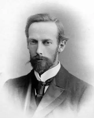
The Bartholomew Family (fl. c. 1810 - 1920) is clan of map publishers active in London through the 19th century. They represent one of the great names in British cartography. The cartographic story of the Bartholomew family begins with George Bartholomew (January, 8 1784 - October 23, 1871, active from 1797), an engraver in the employ of the Daniel Lizars firm of Edinburgh. George was the first of six generations in the Bartholomew map-making dynasty. It was his son, John Bartholomew Sr. (1805 - April 9, 1861) who ultimately founded John Bartholomew and Sons in 1828. The John Bartholomew firm produced thousands of maps and rose to become one of the largest and most prolific cartography firms in Scotland. John Sr. was succeeded by his son, also John Bartholomew Jr. (1831-93). John George Bartholomew (1860-1920), son of John Bartholomew (1831-93) took control of the firm at its height. John George was a charter member of the Royal Scottish Geographical Society and supported the creation of a National Institute of Geography - a good idea that never took off. John George is also reliably attributed to be the first to bring the term "Antarctica" into popular usage as a denominator for the Southern Continent. In recognition of his work, John George was awarded a warrant from the king and often used the title "Cartographer to the King" on his imprint. Among his friends and admirers he was referred to as the "Prince of Cartography". John (Ian) Bartholomew (1890 - 1962) continued the family business and oversaw publication of the Times Survey Atlas of the World in 1922 and the Mid Century Edition of the Time Atlas of the World from 1955 - 1960. John Christoper Bartholomew (1923 - 2008) continued the family business into a fifth generation and was fascinated by the natural sciences. He spearheaded the publication of many of the most detailed and popular maps of the last century. His brother Robert, a trained printer, became production director. Another brother, Peter, an accountant, started as a managing director and eventually became executive chairman. The John Bartholomew firm has been part of the HarperCollins family of publishers since 1989. The vast archive of maps and atlases produced by the Bartholomew family has since been transferred to the National Library of Scotland where it is currently in the cataloguing process.
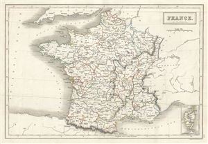
France in Provinces.
$100.00
Acquire
- Digital Map Information
- Suitable for large format printing
- Full resolution TIFF file
- ICC color profile embedded
- Delivered instantly via download link
This is a lovely example of Adam and Charles Black's 1844 map of France. The map covers the Kingdom of France showing its various divisions according to province. It covers from the Flanders in the north to Roussillon in the south and from Brittany in the west to ... (more details)
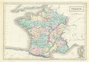
France in Provinces.
$100.00
Acquire
- Digital Map Information
- Suitable for large format printing
- DPI: 300
- File Size: 5.67 MB
- File Type: ZIP / TIFF
- ICC color profile embedded
- Delivered instantly via download link
This is a fine example of Adam and Charles Black's 1851 map of France. The map covers France just prior to the December 2 1851 coup d'etat that brought about the Second empire. In less than a year, the Second Republic transformed into the Second empire, ... (more details)
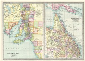
South Australia. Queensland and British New Guinea.
$75.00
Acquire
- Digital Map Information
- Suitable for large format printing
- File Size: 8.53 MB
- File Type: ZIP / TIFF
- ICC color profile embedded
- Delivered instantly via download link
This is a fine example of Bartholomew's 1890 map of South Australia and Queensland in Australia. The map is divided into two parts, with the map on the left featuring the southern part of the Australian state of South Australia and the map on the right ... (more details)
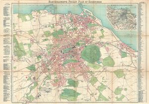
Bartholomew's Pocket Map of Edinburgh.
$300.00
Acquire
- Digital Map Information
- Suitable for large format printing
- File Size: 22.18 MB
- File Type: ZIP / TIFF
- ICC color profile embedded
- Delivered instantly via download link
A scarce c. 1900 map of Edinburgh, Scotland, by John Bartholomew. The map covers Edinburgh from Firth of Forth south as far as Colinton, and from the Ravelston Golf Course eastward as far as Portobello. The map notes all streets, parks, municipal ... (more details)
A rare map of the Arabian Peninsula published with a history of Western knowledge of the region.
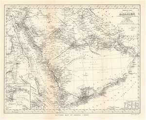
Ritter's Map of Arabia (1852).
$250.00
Acquire
- Digital Map Information
- Suitable for large format printing
- File Size: 7.3 MB
- File Type: ZIP / TIFF
- ICC color profile embedded
- Delivered instantly via download link
This is a 1904 John Bartholomew map of the Arabian Peninsula. A reduction of Heinrich Kiepert’s Ubersichts-Karte von Arabien, the map centers on the Arabian Peninsula and depicts from Egypt to the Gulf of Oman and from Jerusalem to the Bab-el-Mandeb, the strait between Yemen and Djibouti and Eritrea. Cities, towns, and villages throughout the region are labeled, including Jerusalem, Basra, Kuwait City, and Mecca. The route of the Hajj is noted, as are other trade routes and the routes of two German explorers. (more details)
Comprehensive atlas of India and surrounding countries.
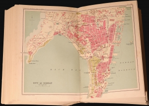
A lovely example of the three-volume Bombay Presidency Series of the Imperial Gazetteer of India, detailing the geography of Bombay, Sindh, and other parts of the Subcontinent, published in 1909 by the Superintendent of Government Printing in Calcutta. This collection includes the scarce atlas volume focusing on the regions and cities, ranging from the Northwest Frontier Provinces to Burma. (more details)
China's terrain.
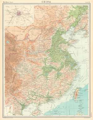
China.
$100.00
Acquire
- Digital Map Information
- Suitable for large format printing
- File Size: 25.48 MB
- File Type: ZIP / TIFF
- ICC color profile embedded
- Delivered instantly via download link
This is a 1922 J.G. Bartholomew terrain map of China. Depicting eastern China from Mongolia to Hainan, Bartholomew employs color to differentiate between six ranges in elevation from sea level to 12,000 feet and above. He also uses color to illustrate ocean depth. Chinese provinces are illustrated and labeled, and cities, town, and villages are identified. An inset map in the upper left corner details Beijing (Peking) and its environs. (more details)
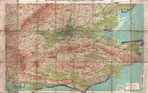
Bartholomew's 'Quarter Inch to Mile' Coutour Road Map of the Environs of London.
$200.00
Acquire
- Digital Map Information
- Suitable for large format printing
- File Size: 36.11 MB
- File Type: ZIP / TIFF
- ICC color profile embedded
- Delivered instantly via download link
This is a rare c. 1928 map of London, England, and its environs. Covers from Portsmouth eastward as far as Ramsgate and northward as far as Oxford and Colchester. Includes London with basic streets and roadways noted Includes routes for road, ... (more details)
Playful pictorial map of Ireland.
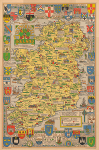
This is a delightful 1969 L. G. Bullock pictorial historical map of Ireland, published by the Edinburgh cartographic firm John Bartholomew and Sons. Combining decorative cartography, Irish history, genealogy, folklore, heraldry, architecture, and national identity, the map presents the island of Ireland as a vibrant tapestry of ancient clans, medieval castles, monastic foundations, historic battlefields, Viking incursions, regional traditions, and cultural landmarks. (more details)