
Bechler, Gustavus R. (sold)

Gustavus R. Bechler (fl. c. 1856 - 1878) was a surveyor and cartographer best known for his work with the U.S. Geological and Geographical Survey of the Territories (USGGST), led by Ferdinand Vandeveer Hayden. He appears to have gotten his start producing maps of counties in Pennsylvania, New York, and Michigan. During the U.S. Civil War, he drew several impressive, large-scale maps of highlighting battles and campaigns. Virtually nothing is known of Bechler's biographical details, despite being one of the more prolific members of USGGST, acting as chief topographer on Hayden's expedition to Yellowstone. The scant notes referring to him by other members of the survey suggest that he was skilled but difficult to work with. The Bechler River in Yellowstone National Park is named for him.
Grand map of Grand Teton.
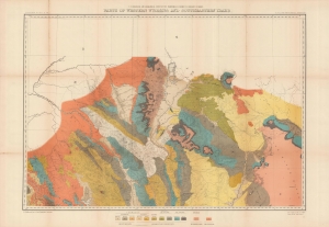
Parts of western Wyoming and southeastern Idaho.
sold
- Digital Map Information
- Suitable for large format printing
- File Size: 46.2 MB
- File Type: ZIP / TIFF
- ICC color profile embedded
- Delivered instantly via download link
A brightly colored, large-format map of Grand Teton and surrounding mountains produced in 1878 by the U.S. Geological and Geographical Survey of the Territories, forerunner to the U.S. Geological Survey. It is among the earliest mappings of this region, and certainly was the most comprehensive at the time of publication. (more details)
Grand map of Grand Teton.
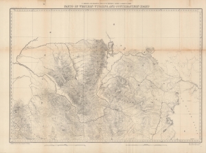
Parts of western Wyoming and southeastern Idaho.
sold
- Digital Map Information
- Suitable for large format printing
- File Size: 43.83 MB
- File Type: ZIP / TIFF
- ICC color profile embedded
- Delivered instantly via download link
A detailed large-format map of Grand Teton and surrounding mountains produced in 1878 by the U.S. Geological and Geographical Survey of the Territories, forerunner to the U.S. Geological Survey. It is among the earliest mappings of this region, and certainly was the most comprehensive at the time of publication. (more details)