
Bernardo de Estrada, Rodrigo (sold)

Rodrigo Bernardo de Estrada (fl. c. 1840 - 1860) was a Cuban lawyer and surveyor active in the middle part of the 19th century. It appears to have had some sort of official designation, but we have been able verify any governmental position. Bernardo de Estrada's work is most frequently associated with Sagua la Grande, Cuba.
Only known chart detailing the entrance to Sagua La Grande during the Cuban Sugar Boom.
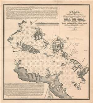
Plano del puerto de Saguya la Grande, el la costa Septentrional de la Isla de Cuba.
sold
- Digital Map Information
- Suitable for large format printing
- File Size: 33.47 MB
- File Type: ZIP / TIFF
- ICC color profile embedded
- Delivered instantly via download link
A rare 1858 Rodrigo Bernardo de Estrada Cuban sugar boom nautical map of the port of Isabela de Sagua (here Boca el Rio) and the entrance to Segua la Grande, Central Cuba. This map was produced to facilitate international shipping from Isabella de Sagua, which in 1858 was connected by rail to the bustling Sagua Valley sugar plantations. The map details the vicinity of Isabela de Sagua, on the north central coast of Villa Clara province. It includes routes through the complex barrier cayos (islands) into the Bahia de Carahatas, the Bahia de Segua la Grande, and the Bahia de Novillo. Textual instructions for the mariner are offered in English and Spanish, suggesting the intended audience for this piece was both Cuban and American. (more details)