
Bonner, William G. (sold)

William G. Bonner (c. 1813 - 1889) was an American civil engineer, surveyor, and cartographer based in Milledgeville, Georgia. Bonner was born in Hancock County, Georgia. He is extremely elusive. We believe it is the W. G. Bonner of Georgia who was admitted as a cadet to the U.S. Military academy at West Point in 1828, when he was 14, and dismissed in 1831. It is likely there that he was trained in surveying and civil engineering. We next find him in Milledgeville, where he complied the seminal 1847 Map of the State of Georgia. Perhaps riding on the success and good reception of this map, in 1848 Bonner was elected Chief Engineer of the East Tennessee and Georgia Railroad. He later served in the same role for the Macon and Warrington Railroad, and the Vicksburg and Shreveport Railroad. He served the Confederate cause during the American Civil War (1861 - 1865), with the rank of colonel. He appears to have owned one slave, a servant named Abram. Afterwards, in 1869, we find a 'William G. Bonner' working as a Civil Engineer in Kingston, New York, and, in 1870, in New York City. We see no records past 1889.
Seminal map of Georgia.
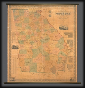
Map of the State of Georgia compiled under the direction of His Excellency George W. Crawford by Wm. G. Bonner, Civil Engineer.
sold
- Digital Map Information
- Suitable for large format printing
- DPI: 600
- File Size: 122.68 MB
- File Type: ZIP / TIFF
- ICC color profile embedded
- Delivered instantly via download link
An excellent example of William G. Bonner's rare, important, and monumental 1847 map of Georgia, here in its first edition, first state. When issued, this was the first major map of the state to appear in almost 20 years, and thus the first to represent Georgia with some approximation of its modern borders. It is, moreover, the first major map to illustrate the westward expansion of Georgia in the 1830s and 40s, with the annexation of Creek and Cherokee territory. It is also one of the few maps to clearly delineate the Georgia-Florida border dispute. (more details)