
Brémond, Laurent (sold)

Laurent Brémond (fl.1700-1730) was a French hydrographer and map printer of the late 17th and early 18th century, styled 'Hydrographer to the King and the town,' the town in question being Marseilles, the port city in which his shop was located. His education and life are obscure. He was credited with several influential cartographic works devoted to the Mediterranean, and was associated with Henri Michelot, hydrographer and Royal navigator for the French Galley Corps. Their works exhibit long experience and understanding of the Mediterranean coasts and harbors they charted. Their charts, particularly the larger, broader-focused ones, featured baroque, bellicose imagery that emphasized French naval power. In addition to several fine, large charts of Corsica and Sardinia, Brémond and Michelot produced the 1718 Ports et Rades de la Mer Méditerranée, which would be reprinted several times.
Fine early nautical chart of Sardinia.
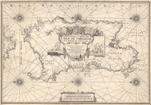
Nouvelle Carte de L'Isle de Sardaigne et partie de Celle de Corce.
sold
- Digital Map Information
- Suitable for large format printing
- DPI: 600
- File Size: 27.85 MB
- File Type: ZIP / TIFF
- ICC color profile embedded
- Delivered instantly via download link
This is a rare 1719 Henri Michelot nautical map of the island of Sardinia, Italy. Michelot was active in the Mediterranean Sea for many years, and his charts benefit from his expertise in those waters - making them among the finest available at the time of publication. Accordingly, coastal features are abundantly named, depth soundings are marked for the island's anchorages, and coastal landmarks such as towers and hills are indicated pictorially. The famous salt flats of Cagliari and the Oristano lagoon are marked as well. (more details)