
Brown, David R. (sold)

David R. Brown (May 30, 1831 - February 22, 1911) was an American architect based in New Haven, Connecticut during the second half of the 19th century. Brown was born in New Haven, where he grew up attending the local public schools. He apprenticed as an architect under Henry Austin, also of New Haven. Upon reaching his maturity, he became a partner in the Austin firm. In 1856, he relocated to Chicago, where he prospered. Despite his success in Chicago, he returned to New Haven in 1860, just in time to be recruited into the Union Army. Brown served as a Second Lieutenant and then Captain in the American Civil War. He was part of the 20th Regiment, Connecticut Infantry until its end, in 1865. Returning to New Haven, he continued his architecture practice. He took the young German immigrant Ferdinand Von Beren (1870 - ????) as an apprentice in 1885. In 1890, Von Beren became a partner in the new firm, Brown and Von Beren. Von Beren took full control of the firm after David Brown died in 1911. While there are many examples of Brown's architecture in New Haven and New York, he cartographic works are limited to a single map of New Haven, published with Charles Currier in 1865.
Rare map of New Haven showing original grantees!
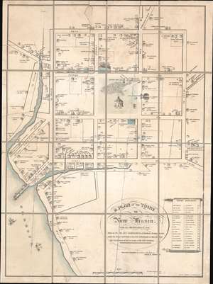
A Plan of the Town of New Haven. With all the Buildings in 1748 Taken by the Hon. Gen. Wadsworth of Durham, To Which Are Added The Name's and Profession's of the Inhabitants at that period, also the Location of Lots to many of the first Grantees.
sold
- Digital Map Information
- Suitable for large format printing
- File Size: 16.17 MB
- File Type: ZIP / TIFF
- ICC color profile embedded
- Delivered instantly via download link
This is a c. 1865 Charles Currier and David R. Brown lithographic reissue of the 1806 Thomas Kensett / James Wadsworth map of New Haven, Connecticut, as it appeared in 1748. The Kensett / Wadsworth map is considered to be the earliest map of New Haven. The map is oriented roughly to the northwest and covers the 9 city blocks surrounding the New Haven Green. It further extends to incorporate the harbor and nearby waterways, most of which have since been altered by landfill projects. The identifies Yale University (built in 1717), the city hall (constructed in 1668), and two trees on the Green plated in 1686. It further notes the location of various c. 1748 private residences, noting the owner's name and profession. In the lower right quadrant, there appears a list of the original 38 grantees, most of which also appear on the map. (more details)