
Callender, Joseph (sold)

Joseph Callender (May 6, 1751 - November 10, 1821) was an American silversmith and copperplate engraver based in Boston, Massachusetts. Callender was bornin Boston and from 1764 apprenticed under Nathaniel Hurd (1729 - 1777). He took his journeymanship in the silversmithing shop of Paul Revere (1734 - 1818). Around 1784 he took over the Hurd ship and expanded his portfolio to copperplate printing and seal engraving, as well as traditional silversmithing. He engraved the seal of the Bank of Massachusetts in 1784 and the first official map of Massachusetts for Osgood Carleton in 1801.
1st Official Map of Massachusetts.

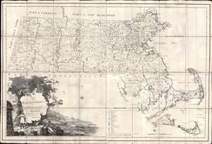
Map of Massachusetts Proper Compiled form Actual Surveys made by Order of the General Court, and under the inspection of Agents of their appointment, by Osgood Carleton.
sold
- Digital Map Information
- Suitable for large format printing
- Full resolution TIFF file
- ICC color profile embedded
- Delivered instantly via download link
Known as 'The Agent's Map', this is a fine example of the first official map of Massachusetts, published in 1801 by Osgood Carleton. The map emerged out of a long and complex struggle to produce a large-scale, accurate, and comprehensive state map - something increasingly important in the heady early days of independence following the American Revolutionary War (1775 - 1783). This expansive map covers all of Massachusetts in considerable detail, giving no attention whatsoever to the neighboring states. While generally ignoring topography, the map offers superb practical detail throughout, noting roads, county borders, schools, meeting houses, courts, milage from Boston, and more. The sole mountain illustrated is the Hoosack Range, near modern-day North Adams. (more details)
1st Official Map of Massachusetts.
Map of Massachusetts Proper Compiled form Actual Surveys made by Order of the General Court, and under the inspection of Agents of their appointment, by Osgood Carleton.
sold
- Digital Map Information
- Suitable for large format printing
- Full resolution TIFF file
- ICC color profile embedded
- Delivered instantly via download link
Known as 'The Agent's Map', this is a fine example of the first official map of Massachusetts, published in 1801 by Osgood Carleton. The map emerged out of a long and complex struggle to produce a large-scale, accurate, and comprehensive state map - something increasingly important in the heady early days of independence following the American Revolutionary War (1775 - 1783). This expansive map covers all of Massachusetts in considerable detail, giving no attention whatsoever to the neighboring states. While generally ignoring topography, the map offers superb practical detail throughout, noting roads, county borders, schools, meeting houses, courts, milage from Boston, and more. The sole mountain illustrated is the Hoosack Range, near modern-day North Adams. (more details)
First Official Map of Massachusetts.
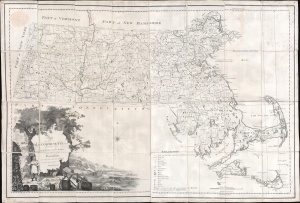
Map of Massachusetts Proper Compiled form Actual Surveys made by Order of the General Court, and under the inspection of Agents of their appointment, by Osgood Carleton.
sold
- Digital Map Information
- Suitable for large format printing
- DPI: 600
- File Size: 141.25 MB
- File Type: ZIP / TIFF
- ICC color profile embedded
- Delivered instantly via download link
Known as 'The Agent's Map', this is a fine example of the first official map of Massachusetts, published in 1801 by Osgood Carleton. The map emerged out of a long and complex struggle to produce a large-scale, accurate, and comprehensive state map - something increasingly important in the heady early days of independence following the American Revolutionary War (1775 - 1783). This expansive map covers all of Massachusetts in considerable detail, giving no attention whatsoever to the neighboring states. While generally ignoring topography, the map offers superb practical detail throughout, noting roads, county borders, schools, meeting houses, courts, milage from Boston, and more. The sole mountain illustrated is the Hoosack Range, near modern-day North Adams. (more details)