
Caplin, Jean-François (sold)

Jean-François Caplin (1779 - c. 1829) was a French engraver. He worked for the Dépôt de la Marine and the Administration des Ponts et Chuassées and created topographic maps and nautical charts.
Renewed French imperialist interest in the Americas.
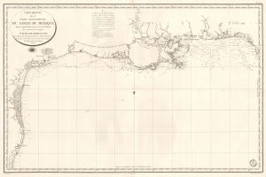
Carte Réduite de la Partie Septentrionale du Golfe du Mexique Depuis Laguna Madre jusqu'à la Côte de la Floride.
sold
- Digital Map Information
- Suitable for large format printing
- Full resolution TIFF file
- ICC color profile embedded
- Delivered instantly via download link
This is an 1826 French Dépôt de la Marine nautical chart or maritime map of the Gulf Coast. The publication of this map for French audiences reflects renewed and growing imperial interest in the New World on the part of France. (more details)