
Carrigain, Philip (sold)

Philip Carrigain (February 20, 1772 - March 16, 1842) was an American cartographer, surveyor, and politician active in New Hampshire during the late 18th and early 19th centuries. Carrigain was born in Concord, New Hampshire and attended Dartmouth College. He graduated with a law degree in 1794 and after practicing law for several years entered New Hampshire politics. From 1805-1808 he was New Hampshire's Secretary of State. Historian Amos Hadly wrote of Carrigain, "never has there been in New Hampshire one holding the office of executive recorder more talented and versatile, more witty and genial, more gentlemanly in manners, and more artistic in tastes." He had a knack for words and coined the state's nickname, "The Granite State". Carrigain is best known however, for his monumental wall map of New Hampshire, published in 1816. This map, most likely the most important American map of New Hampshire ever published, is admired for its extraordinary accuracy, detail, elegance, and overall beauty. The meticulous work of overseeing the engraving of the New Hampshire map apparently left Carrigain's eyesight sorely diminished. This great map, commonly called the 'Carrigain Map', was his only published cartographic work and produced no further maps, returning instead to the legal profession. Carrigain lived out his final days in a large home in Concord called, "Carrigain Commons" or mockingly, "Carrigain's Folly", for he built the house for a young bride who abandoned him at the altar. Carrigain sadly died in poverty on March 16, 1842 and was interred in the Old North Cemetery in Concord, New Hampshire. He is remembered by his great map and, of course, Mt. Carrigain, which was named after him.
The first great 19th century state map.
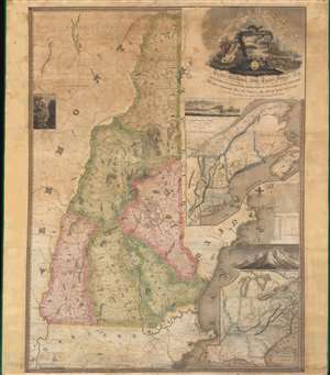
New Hampshire by Recent Survey Made Under the Supreme Authority and Published according to Law by Philip Carrigain Consellor at Law and late Secretary of the State. / New Hampshire To his Excellency Jon Taylor Gilman Esq. and to the Honourable the Legislature of the State of New Hampshire this Map commenced under their Auspices and matured by their Patronage is most respectfully inscribed by their Obliged Servant Philip Carrigain.
sold
- Digital Map Information
- Suitable for large format printing
- Full resolution TIFF file
- ICC color profile embedded
- Delivered instantly via download link
A scarce and monumental cartographic achievement, this is Philip Carrigain's 1816 map of New Hampshire. Carrigain's map is without a doubt the largest and most important specific map of New Hampshire ever published. This vast and beautifully produced map covers the entire state of New Hampshire as well as adjacent parts of Vermont, Massachusetts (as far as Boston), and Maine. An inset at right details the greater New York and New England region. A secondary inset in the lower right focuses on the United States east of the Mississippi River. (more details)
The Carrigain Map' is the most important American map of New Hampshire ever published.
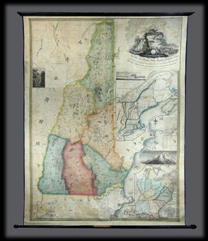
New Hampshire by Recent Survey Made Under the Supreme Authority and Published according to Law by Philip Carrigain Consellor at Law and late Secretary of the State. / New Hampshire To his Excellency Jon Taylor Gilman Esq. and to the Honourable the Legislature of the State of New Hampshire this Map commenced under their Auspices and matured by their Patronage is most respectfully inscribed by their Obliged Servant Philip Carrigain.
sold
- Digital Map Information
- Suitable for large format printing
- Full resolution TIFF file
- ICC color profile embedded
- Delivered instantly via download link
A scarce and monumental cartographic achievement, this is Philip Carrigain's 1816 map of New Hampshire. Carrigain's map is without a doubt the largest and most important specific map of New Hampshire ever published. This vast and beautifully produced map covers ... (more details)
The very rare second edition of the first great 19th century state map.
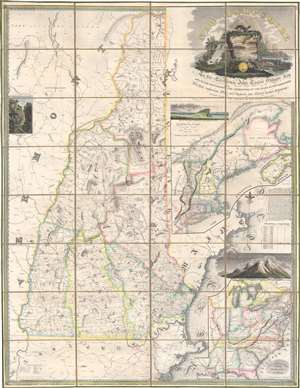
New Hampshire by Recent Survey Made Under the Supreme Authority and Published according to Law by Philip Carrigain Consellor at Law and late Secretary of the State. / New Hampshire To his Excellency Jon Taylor Gilman Esq. and to the Honourable the Legislature of the State of New Hampshire this Map commenced under their Auspices and matured by their Patronage is most respectfully inscribed by their Obliged Servant Philip Carrigain.
sold
- Digital Map Information
- Suitable for large format printing
- Full resolution TIFF file
- ICC color profile embedded
- Delivered instantly via download link
A scarce and monumental cartographic achievement, this is the scarce 1818 second edition of Philip Carrigain's wall map of New Hampshire. Carrigain's map is without a doubt the largest and most important specific map of New Hampshire ever published. This beautifully produced map covers New Hampshire as well as adjacent parts of Vermont, Massachusetts (as far as Boston), and Maine. An inset at right details the greater New York and New England region. A secondary inset in the lower right focuses on the United States east of the Mississippi River. (more details)