
Chanlaire, Pierre-Gilles (sold)

Pierre-Gilles Chanlaire (June 21, 1758 - March 8, 1817), also known as Pierre Grégoire Chanlaire, was a French geographer who worked for the Bureau of Topography and Land Registry. He married Angélique-Émilie Vermeil on April 26, 1787 with whom he had two children.
Florida during the second Spanish period when it became a refuge for escaped slaves and American Indian tribes who regularly raided the United States.
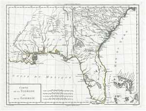
Carte de la Floride et de la Georgie.
sold
- Digital Map Information
- Suitable for large format printing
- DPI: 300
- File Size: 5.76 MB
- File Type: ZIP / TIFF
- ICC color profile embedded
- Delivered instantly via download link
This is a stunning 1798 Pierre Antoine-François Tardieu map of Florida and Georgia. The map depicts the region from Louisiana to the Atlantic Ocean and from South Carolina to the Gulf of Mexico. Some Historical Context Created during the second era of Spanish rule ... (more details)
Spanish Florida: a volatile frontier of Native nations, runaway slaves, and imperial rivalry.
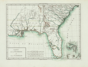
Carte de la Floride et de la Georgie.
sold
- Digital Map Information
- Suitable for large format printing
- Full resolution TIFF file
- ICC color profile embedded
- Delivered instantly via download link
This is Pierre François Antoine Tardieu's 1798 map of Spanish Florida and Georgia. With coverage from Louisiana to the Atlantic Ocean and from South Carolina to the Gulf of Mexico, this map was issued during the second era of Spanish rule in Florida. At this time, Florida became a haven for runaway slaves and a base of operations for Native American attacks on the United States. The map is printed on striking French Revolutionary period blue-tinted paper. (more details)