
Clark, Henry (sold)

Henry Clark (May 1817 - March 1893) was an English lithographer active in London during the middle part of the 19th century. Clark was born in Holborn, the son of goldsmith William Clark (Hatton Green). It is not clear where he learnt lithography, but he was active at a shop at 10 Bucklersbury, City of London, in 1844, a location previous associated with John James Davis. Later in 1844 he formed a partnership with James Contencin (1814 - 1879) at 9 Pancras Lane, London. That partnership was dissolved in 1847. Later he relocated to Rotterdam. He may have been associated with the Quakers or the Society of Friends. He died at his home in Rotherham, Yorkshire West Riding, England.
American Indian Nations.
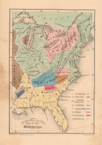
Aboriginal America, East of the Mississippi.
sold
- Digital Map Information
- Suitable for large format printing
- Full resolution TIFF file
- ICC color profile embedded
- Delivered instantly via download link
A fascinating 1844 map of the United States east of the Mississippi illustrates the territories of the great American Indian Nations. This map was made for the Society of Friends (Quakers) Aborigines' Committee of the Meetings of Sufferings, an annual meeting focused on the wrongs done to indigenous peoples. (more details)
Trail of Tears and other American Indian Relocations.
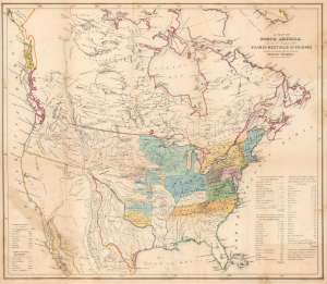
A Map of North America denoting the boundaries of the Yearly Meetings of Friends and the locations of the various Indian Tribes.
sold
- Digital Map Information
- Suitable for large format printing
- File Size: 20.53 MB
- File Type: ZIP / TIFF
- ICC color profile embedded
- Delivered instantly via download link
A fascinating 1844 map of the United States, the Republic of Texas, and Canada. This map was made for the annual Society of Friends (Quakers) Aborigines' Committee of the Meetings of Sufferings. This was an annual meeting focused on the wrongs done to indigenous peoples. The map also serves the dual purpose of illustrating the regional geographical chapters of the Quakers in relation to their annual meetings. American Indian nations are identified throughout as are assigned reservations west of the Mississippi. The map also illustrates the Republic of Texas at its largest. (more details)
Trail of Tears and other American Indian Relocations.
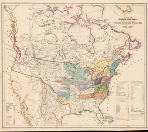
A Map of North America denoting the boundaries of the Yearly Meetings of Friends and the locations of the various Indian Tribes.
sold
- Digital Map Information
- Suitable for large format printing
- Full resolution TIFF file
- ICC color profile embedded
- Delivered instantly via download link
A fascinating 1844 map of the United States, the Republic of Texas, and Canada. This map was made for the Society of Friends (Quakers) Aborigines' Committee of the Meetings of Sufferings, an annual meeting focused on the wrongs done to indigenous peoples. The map also serves the dual purpose of illustrating the regional geographical chapters of the Quakers in relation to their annual meetings. American Indian nations are identified throughout, as are assigned reservations west of the Mississippi. The map here illustrates the Republic of Texas at its largest. (more details)
Unusual dual purpose map illustrating both American Indian lands and Quaker annual meetings.
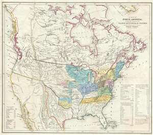
A Map of North America denoting the boundaries of the Yearly Meetings of Friends and the locations of the various Indian Tribes.
sold
- Digital Map Information
- Suitable for large format printing
- Full resolution TIFF file
- ICC color profile embedded
- Delivered instantly via download link
A fascinating 1844 map of the United States, the Republic of Texas, and Canada. This map was made for the annual Society of Friends (Quakers) Aborigines' Committee of the Meetings of Sufferings. This was an annual meeting focused on the wrongs done to indigenous ... (more details)
Unusual dual purpose map illustrating both American Indian lands and Quaker annual meetings.
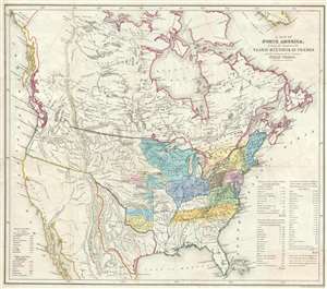
A Map of North America denoting the boundaries of the Yearly Meetings of Friends and the locations of the various Indian Tribes.
sold
- Digital Map Information
- Suitable for large format printing
- DPI: 300
- File Size: 9.25 MB
- File Type: ZIP / TIFF
- ICC color profile embedded
- Delivered instantly via download link
A fascinating 1844 map of the United States, the Republic of Texas, and Canada. This map was made for the annual Society of Friends (Quakers) Aborigines' Committee of the Meetings of Sufferings. This was an annual meeting focused on the wrongs done to indigenous ... (more details)