
Condet Gerard (sold)

Gerard Condet (1715 – 1764), aka Gerard Kondet or Gerardus Condet, was a Dutch line engraver active in The Hague during the early 18th century.
The first map to provide Europeans with information about Korea.
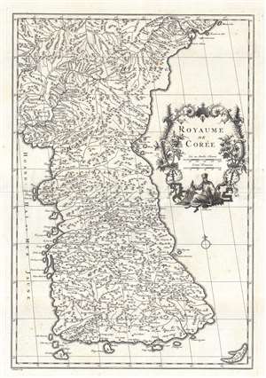
Royaume de Corée.
sold
- Digital Map Information
- Suitable for large format printing
- Full resolution TIFF file
- ICC color profile embedded
- Delivered instantly via download link
This is Jean Baptiste Bourguignon d'Anville's (1697 - 1782) landmark 1737 map of Korea - the first map to introduce Korea to Europe. It is the first European published map to provide detailed cartographic data on Korea including a breakdown of Korean provinces with a reasonably accurate nomenclature. It further provides valuable references relating to the Dokdo / Ulleungdo dispute between Korea and Japan. (more details)
First European map of Korea.
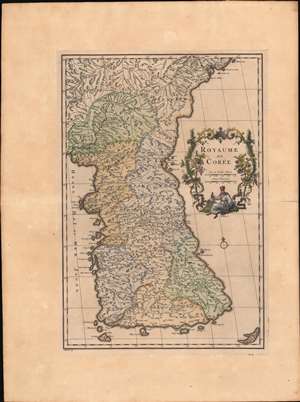
Royaume de Corée.
sold
- Digital Map Information
- Suitable for large format printing
- Full resolution TIFF file
- ICC color profile embedded
- Delivered instantly via download link
This is Jean Baptiste Bourguignon d'Anville's landmark 1737 map of Korea - the first map to introduce Korea to Europe. It is the first European published map to provide detailed cartographic data on Korea including a breakdown of Korean provinces with a reasonably accurate nomenclature. It further provides valuable references relating to the Dokdo / Ulleungdo dispute between Korea and Japan. (more details)