
Conway, Frederick Rector (sold)

Frederick Rector Conway (July 4, 1799 - December 16, 1874) was an American surveyor and cartographer. Born in Tennessee, Conway was one of seven brothers. He and his family moved from Tennessee to Missouri in 1818. Conway was appointed the Surveyor General of Illinois and Missouri at St. Louis on May 12, 1845 and was notified the following day. He was also known by another title, Surveyor of the Public Lands in the States of Illinois and Missouri. According to an obituary, Conway had been sick for some time at the time of his death, but his illness had not been considered life threatening.
Evolution of Missouri's borders.
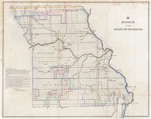
H Diagram of the State of Missouri.
sold
- Digital Map Information
- Suitable for large format printing
- Full resolution TIFF file
- ICC color profile embedded
- Delivered instantly via download link
This is an 1845 Frederick R. Conway Land Office survey map of Missouri. The state has been platted into townships, with letters 's', 'z', 'o', and 'x' indicating the status of each township's survey. Districts within the state are labeled, and cities and towns are identified, including St. Louis, Palmyra, and Hannibal. The evolution of Missouri's borders is traced as well, with lines marking the 'Old Indian Boundary Line', the 'north boundary of the State if Missouri as established by the state commissioners in 1837', and the 'old west boundary of the State of Missouri.' (more details)
The platting of the Northwest Ordnance.
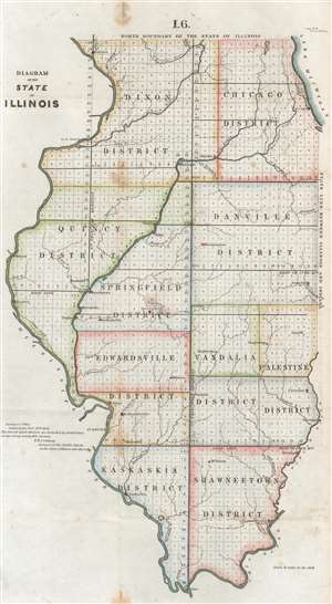
Diagram of the State of Illinois.
sold
- Digital Map Information
- Suitable for large format printing
- Full resolution TIFF file
- ICC color profile embedded
- Delivered instantly via download link
This is an 1845 Frederick R. Conway map of Illinois. The state has been platted into townships. The township was created as the measure of the Public Land Survey System, which was first widely implemented to survey the Northwest Ordinance, including Illinois. The Public Land Survey System allowed for the systematic surveying and mapping of any territory gained by the United States. Cities and towns are labeled, including Chicago, Hennepin, Peoria, Springfield, and Bloomington. Major rivers are illustrated and identified, with Lake Michigan filling the upper right. (more details)