
Cowley, John Lodge (sold)

John Lodge Cowley (1719 - 1797) was an English cartographer, geologist and mathematician. John Cowley was a professor of mathematics at the Royal Military Academy, Woolwich, London, for a number of years between 1761 and 1773. He was elected a Fellow of the Royal Society in April, 1768. His mathematical methods were famous, but he was also an important geographer as well as Royal Geographer to King George II. He specialized in maps that depicted the counties of the United Kingdom from which arose his most famous work, Counties of England. Cowley published several maps often in conjunction with Emanuel Bowen, engraver. Among his more notable works are superb engravings representing the constellations drawn on glass globes created by Thomas Heath. He also, in his capacity of Royal Geographer, published an important rutter of the Windward Passage to the benefit of English plantation trade in the West Indies. Cowley taught geometry to subscribers of the St. Martin's Lane Academy, a drawing school established by William Hogarth and John Ellys. He died in Walworth, Surrey, and was survived by a daughter, Mrs. Johnstone, who inherited her father's passion for cartography.
Scarce Rutter deatiling the Windward Passage.
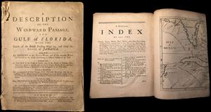
A Description of the Windward Passage and Gulf of Florida, with the course of the British Trading-Ships to, and from the Island of Jamaica. Also an Account of the Trade-Winds and Currents on the Coasts thereabouts, at different Seasons of the Year. Illsutrated with a Chart of the Coast of Florida, and of the Islands of Bahama, Cuba, Hispaniola, Jamaica, and the adjacent smaller Islands, Shoals, Rocks, and other remarkable Things in the Course of the Navigation in the West Indies.
sold
- Digital Map Information
- Suitable for large format printing
- File Size: 1.78 MB
- File Type: ZIP / TIFF
- ICC color profile embedded
- Delivered instantly via download link
An extremely rare first edition of John Cowley's rutter (nautical guidebook) of the West Indies, particularly the important Windward Passage between Cuba and Hispaniola. This document was intended for navigators and tradesmen with an interested in the English ... (more details)
The earliest obtainable specific map of the Galapagos Islands.
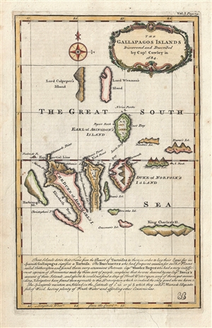
The Gallapagos Islands Discovered and Described by Capt. Cowley in 1684.
sold
- Digital Map Information
- Suitable for large format printing
- DPI: 300
- File Size: 2.82 MB
- File Type: ZIP / TIFF
- ICC color profile embedded
- Delivered instantly via download link
This is one of the earliest obtainable specific maps of the Galapagos Islands. The map tentatively covers the islands and is attributed to Captain William Ambrose Cowley. The map claims that Cowley discovered the islands in 1683, but in fact they were know ... (more details)