
Cuylenburg, John van (sold)

John van Cuylenburg (1862 - 1940) was a Dutch surveyor active in British colonies in South Asia, Malay, Singapore, and the East Indies - taking a leading role in some of the most significant regions mappings of the early 20th century. Cuylenburg was born in Colombo, Ceylon, the son of surveyor John E. van Cuylenburg. He studied at the Colombo Academy (Royal College), exhibiting an aptitude for mathematics and drawing. In 1881, he was recommended for cartographic draughtsman position with the Singapore Surveyor General Office. After arriving in Singapore, he was near immediately reassigned to Malacca, where he worked on surveys of the Malay Peninsula. He returned to Singapore in 1885, where he compiled and drafted an important map of Singapore island (Singapore: Surveyor General’s Office, 1885; revised and reissued in 1898). In 1888, he was appointed District Surveyor of Singapore - work which focused on cadastral surveys and development work around the island. He was deeply involved in learned and scientific societies in Singapore, particularly the Royal Asiatic Society. He also helped to sponsor and organize scientific expeditions in the area, some of which he participated in directly, including the 1901 Indian Ocean mapping of Christmas Island. His son, John Bertram van Cuylenburg became one of Singapore’s leading physicians, also known for his fascinating memoirs of life in the city, covering the early 20th Century and the World War II-era (Sunshine and Shadow, Singapore, 1982). For information on Cuylenburg, see Arnold Wright, Twentieth Century impressions of British Malaya: its history, people, commerce, industries, and resources (London, 1908), p. 323.
British Colonial 'masterplan' of Malaya.
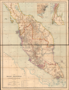
A Map of the Malay Peninsula Compiled by and Published for The Straits Branch of the Royal Asiatic Society Singapore.
sold
- Digital Map Information
- Suitable for large format printing
- File Size: 165.58 MB
- File Type: ZIP / TIFF
- ICC color profile embedded
- Delivered instantly via download link
One of the most important 19th-century maps of the Malay Peninsula to appear on the market in recent decades, this is the definitive large-scale 1898 masterplan created by and for the colonial administration of British Malaya. This chromolithograph map captures a critical moment in Malay history when Britain was beginning to consolidate its suzerainty over the resource-rich peninsula. The present example has an interesting provenance associating it with the assassinated rubber planter Sir John St. Maur Ramsden. (more details)
British Colonial 'masterplan' of Malaya.
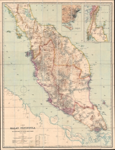
A Map of the Malay Peninsula Compiled by and Published for The Straits Branch of the Royal Asiatic Society Singapore.
sold
- Digital Map Information
- Suitable for large format printing
- File Size: 132.16 MB
- File Type: ZIP / TIFF
- ICC color profile embedded
- Delivered instantly via download link
One of the most important 19th-century maps of the Malay Peninsula to appear on the market in recent decades, this is the definitive large-scale 1898 masterplan created by and for the colonial administration of British Malaya. This chromolithograph map captures a critical moment in Malay history where Britain was beginning to consolidate its suzerainty over the resource-rich peninsula. (more details)