
Davies, Bryer, and Company (sold)

Davies, Bryer, and Company (fl. 1866 – 1872) was an English, London based, map engraving firm active in the middle part of the 19th century. The partnership consisted of 'Davies' who may or may not be the prominent map engraver Benjamin Rees Davies (1789 - 1872) and Frederick Bryer (1840 – 1919). The firm was contracted by the British Admiralty Hydrographic Office to engrave several important nautical charts in the 1860s through the 1870s. The partnership appears to have dissolved around 1872 and, although both publishers continued to engrave charts independently, no later charts bear the Davies, Bryer and Company imprint.
The first major resurvey of the Singapore Straits since the 1840s.
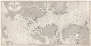
China Sea Singapore Strait.
sold
- Digital Map Information
- Suitable for large format printing
- File Size: 67.1 MB
- File Type: ZIP / TIFF
- ICC color profile embedded
- Delivered instantly via download link
A rare 1870 British Admiralty nautical chart or maritime map of the Singapore Strait. Centered Singapore city and the narrow strait between Singapore Island and Pulo Battam (Pulau Batam) the map extends west as far as the Malacca Strait and east to South Channel ... (more details)