
Delamarche, Charles-François

Charles-François Delamarche (August 1740 - October 31, 1817) founded the important and prolific Paris-based Maison Delamarche map publishing firm in the late 18th century. A lawyer by trade, Delamarche entered the map business with the 1787 acquisition from Jean-Baptiste Fortin of Robert de Vaugondy's map plates and copyrights. Delamarche appears to have been of dubious moral character. In 1795, the widow of Didier Robert de Vaugondy, Marie Louise Rosalie Dangy, petitioned a public committee for 1500 livres, which should have been awarded to her deceased husband. However, Delamarche, proclaiming himself Vaugondy's heir, filed a simultaneous petition and walked away with the funds, most of which he was instructed to distribute to Robert de Vaugondy's widow and children. Just a few months later, however, Delamarche proclaimed Marie Dangy deceased, and it is highly unlikely that any funds found their way to Robert de Vaugondy's impoverished daughters. Nonetheless, where Robert de Vaugondy could barely make ends meet as a geographer, Delamarche prospered as a map publisher, acquiring most of the work of earlier generation cartographers Lattre, Bonne, Desnos, and Janvier, thus expanding significantly upon the Robert de Vaugondy stock. Charles Delamarche eventually passed control of the firm to his son Felix Delamarche (c. 1750 - c. 1850) and geographer Charles Dien (1809 - 1870). It was later passed on to Alexandre Delamarche, who revised and reissued several Delamarche publications in the mid-19th century. The firm continued to publish maps and globes until the middle part of the 19th century.
Striking map of Asia offering the best cartography of the period.
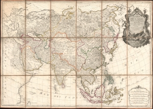
Carte de L'Asie divisée en ses principaux Etats.
$2,250.00
Acquire
- Digital Map Information
- Suitable for large format printing
- Full resolution TIFF file
- ICC color profile embedded
- Delivered instantly via download link
An exceptional large-format separate-issue c. 1779 map of Asia issued by Rigobert Bonne and Charles-François Delamarche. The map is a compilation of the best cartographic information regarding Asia available at the time of publication. (more details)
Spectacularly presented.
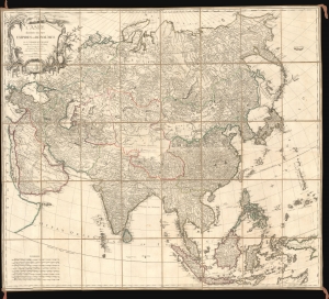
L'Asie divisée en ses Empires et Royaumes.
$3,500.00
Acquire
- Digital Map Information
- Suitable for large format printing
- Full resolution TIFF file
- ICC color profile embedded
- Delivered instantly via download link
A spectacularly presented c. 1787 Charles-François Delamarche / Robert de Vaugondy map of Asia. The beautifully presented map is laid down on unusual patterned linen and set into a fine royal blue slipcase with gold gilt tooling. (more details)
After the Revolution.
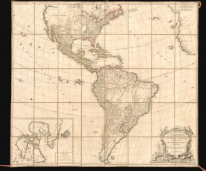
L'Amérique Septentrionale et Méridionale divisée suivant ses différens pays.
$4,500.00
Acquire
- Digital Map Information
- Suitable for large format printing
- Full resolution TIFF file
- ICC color profile embedded
- Delivered instantly via download link
A spectacularly presented c. 1787 Charles-François Delamarche / Robert de Vaugondy map of America. The map reflects the ephemeral political comportment of North America shortly after the American Revolutionary War (1775 - 1783). In South America, it illustrates the complex balance of territories, missions, and indigenous cultures that, within a decade, would give way to an extended period of conflict, wars of liberation, and civil strife. The beautifully presented map is laid down on unusual patterned linen and set into a fine royal blue slipcase with gold gilt tooling. (more details)
Separately-issued Celestial Charts.
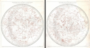
Hémisphère Céleste Arctique ou Septentrional calculé et construit pour l’année 1763 ... / Hémisphère Céleste Antarctique ou Austral calculé et construit pour l’année 1763 ...
$2,500.00
Acquire
- Digital Map Information
- Suitable for large format printing
- File Size: 66.13 MB
- File Type: ZIP / TIFF
- ICC color profile embedded
- Delivered instantly via download link
This is a stunning c. 1787 pair of separately issued celestial maps by Didier Robert de Vaugondy and Charles-François Delamarche. The maps employ a two-plate engraving system to highlight constellations in red - a unique feature not replicated elsewhere in Robert de Vaugondy's corpus. (more details)
Partitioning and reconstituting Poland.
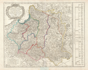
Carte générale du théatre de la guerre en Pologne… Corrigée et Divisée selon les Partages faits en 1772, 1793 et 1795 entre la Russie, la Prusse et l'Autriche.
$750.00
Acquire
- Digital Map Information
- Suitable for large format printing
- DPI: 300
- File Size: 18.87 MB
- File Type: ZIP / TIFF
- ICC color profile embedded
- Delivered instantly via download link
A rare 1807 Robert de Vaugondy/Charles Delamarche map illustrating the partitioning of Poland between 1772 and 1795. The map follows the 1807 Treaty of Tilsit, through which Napoleon reconstituted the Pre-Partition 1772 Polish-Lithuanian Commonwealth. (more details)
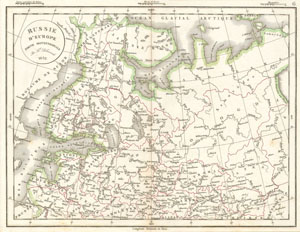
Russie d'Europe partie Septentrionale.
$100.00
Acquire
- Digital Map Information
- Suitable for large format printing
- Full resolution TIFF file
- ICC color profile embedded
- Delivered instantly via download link
This is a fine example of the 1832 Delamarche map of european Russia. It covers the northern part of european Russia from the Arctic Ocean to Moscow and from Sweden to the Ural Mountains. In 1825, Russian army officers, called the Decembrists, protested against ... (more details)
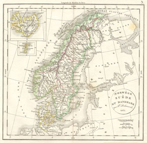
Norwege Suede et Danemark.
$125.00
Acquire
- Digital Map Information
- Suitable for large format printing
- Full resolution TIFF file
- ICC color profile embedded
- Delivered instantly via download link
This is a fine example of the 1832 Delamarche map of Norway, Sweden and Denmark. Centered on the Kingdom of Sweden, it covers all of Scandinavia, from the Arctic Ocean to Denmark and from Norway to the Gulf of Bothnia. Two inset maps in the top left quadrant ... (more details)
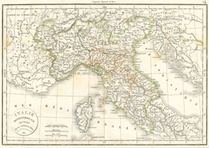
Italie Septentrionale Divisee en ses differens Etats.
$160.00
Acquire
- Digital Map Information
- Suitable for large format printing
- Full resolution TIFF file
- ICC color profile embedded
- Delivered instantly via download link
This hand colored map is a copper plate engraving, dating to 1832 by the well known French mapmaker Delamarche. It is a representation of Northern Italy and Corsica. Depicts the region in considerable detail and indicates the various duchies such as Toscane ... (more details)
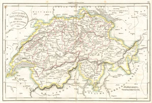
Republique Helvetique Divisee en ses 22 cantons.
$90.00
Acquire
- Digital Map Information
- Suitable for large format printing
- Full resolution TIFF file
- ICC color profile embedded
- Delivered instantly via download link
This hand colored map is a copper plate engraving, dating to 1832 by the well known French mapmaker Delamarche. It is a representation of ... (more details)
Biblical History in Modern Context.
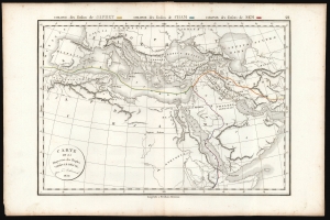
Carte de la Dispersion des Peuples 'Après le Déluge. Par Fx. Delamarche 1830.
$200.00
Acquire
- Digital Map Information
- Suitable for large format printing
- DPI: 600
- File Size: 26.28 MB
- File Type: ZIP / TIFF
- ICC color profile embedded
- Delivered instantly via download link
This is an elegantly-engraved map of the ancient world, depicting the resettlement of the children of Noah after the Biblical flood. It was printed in 1832 by Felix Delamarche. (more details)
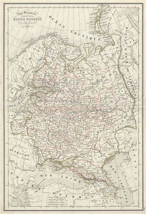
Russie d'Europe.
$125.00
Acquire
- Digital Map Information
- Suitable for large format printing
- DPI: 300
- File Size: 8.08 MB
- File Type: ZIP / TIFF
- ICC color profile embedded
- Delivered instantly via download link
This is a beautiful example of Alexandre Delamarche's 1850 map of Russia. It covers the european part of Russia from Sweden to the Ural ... (more details)
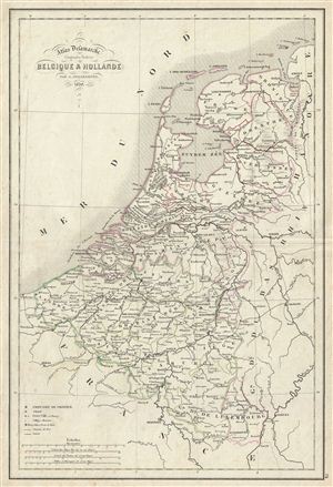
Belgique & Hollande.
$100.00
Acquire
- Digital Map Information
- Suitable for large format printing
- DPI: 300
- File Size: 7.47 MB
- File Type: ZIP / TIFF
- ICC color profile embedded
- Delivered instantly via download link
This is a beautiful example of Alexandre Delamarche's 1850 map of Holland (the Netherlands) and Belgium. It covers from the North Sea ... (more details)
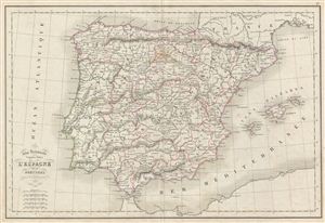
l'Espagne et le Portugal.
$100.00
Acquire
- Digital Map Information
- Suitable for large format printing
- DPI: 300
- File Size: 7.58 MB
- File Type: ZIP / TIFF
- ICC color profile embedded
- Delivered instantly via download link
This is a beautiful example of Alexandre Delamarche's 1850 map of Spain and Portugal. It covers all of Spain and Portugal from the ... (more details)
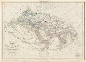
Carte du Monde Connu des Anciens au Temps de Ptolemee.
$150.00
Acquire
- Digital Map Information
- Suitable for large format printing
- DPI: 300
- File Size: 6.99 MB
- File Type: ZIP / TIFF
- ICC color profile embedded
- Delivered instantly via download link
This is a beautiful example of Alexandre Delamarche's 1850 map of the ancient world, including Asia, europe and Africa. The map ... (more details)