
Delaune, Émile (sold)

Émile Delaune (18?? - 19??) was a French intaglio engraver active in Paris in the late 19th and early 20th centuries. He studied engraving under Étienne Collin II (1790 - 1852) and was respected as a versatile and meticulous engraver. He is known to have engraved for the Service Géographique de l'Armée, the Dépôt des Cartes et Plans de la Marine, as well as for Louis Vivien de Saint-Martin and Hachette et Cie. One of his students was the respected Czech engraver and printmaker Vojtěch Preissig (1873 - 1944).
'An orientalist's fantasy...'
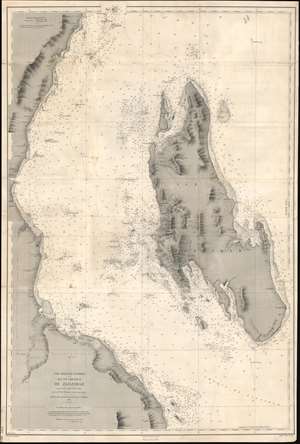
Côte Orientale d'Afrique. Ile et Chenaux de Zanzibar d'aprés le levé exécuté en 1873 et 1874.
sold
- Digital Map Information
- Suitable for large format printing
- File Size: 40.13 MB
- File Type: ZIP / TIFF
- ICC color profile embedded
- Delivered instantly via download link
An extremely rare 1891 French spice trade nautical chart or maritime map of Zanzibar Island or Unguja, off the coast of modern-day Tanzania. This is among the most detailed 19th century maps focusing on Zanzibar we have encountered. Coverage embraces the entire island as well as, the Zanzibar Channel, and the modern-day Tanzania coast from just south of Pemba Island to just north of Dar es Salaam. The largest town shown on the Africa coast is Bagamoyo. On the island, spice plantations are marked by clusters of palm trees and buildings. There are some manuscript updates and revisions around Stone Town. (more details)