
Denis, Louis (sold)

Louis Denis (1725-1794) was a Paris based engraver, cartographer, and publisher. Little is known of Denis, but he held the titles of Géographe des Enfants de France and Géographe du duc de Berry (future Louis XVI). These positions essentially involved tutoring the young prince in geography. He is best known for his incomplete road atlas of France, Le Conducteur Français.. He was a relative of an often worked with Martial Denis, also an engraver. Denis also worked with fellow engraver Louis-Charles Desnos.
Separate issue map illustrating the ramifications of the American Revolutionary War in the East Indies.
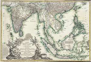
Carte du Theatre De La Guerre Dans L'inde ou se Trouvent Une Partie de La Chine, Les Iles De Sumatra, Java, Borneo, Moluques et Philippines. Dressee d'apres les Meilleures Cartes tant Francaises qu'Anglaises.
sold
- Digital Map Information
- Suitable for large format printing
- Full resolution TIFF file
- ICC color profile embedded
- Delivered instantly via download link
A rare and important 1781 separately issued map of the East Indies by Andre Basset. This map was issued to illustrate a series of conflicts in India and East Indies associated with the American Revolutionary War (1775–1783), including the Anglo-French War ... (more details)
The American Revolutionary War - in SE Asia!
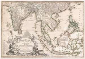
Carte du Theatre De La Guerre Dans L'inde ou se Trouvent Une Partie de La Chine, Les Iles De Sumatra, Java, Borneo, Moluques et Philippines. Dressee d'apres les Meilleures Cartes tant Francaises qu'Anglaises.
sold
- Digital Map Information
- Suitable for large format printing
- Full resolution TIFF file
- ICC color profile embedded
- Delivered instantly via download link
A rare and important 1781 separately issued map of the East Indies by Andre Basset. This map was issued to illustrate a series of conflicts in India and East Indies associated with the American Revolutionary War (1775 - 1783), including the Anglo-French War (1778 - 1783), Fourth Anglo-Dutch War (1780 - 1784), and the Second Anglo-Mysore War (1780 - 1784). The theater of war described is a vast expanse of East Asian territory centered on the Malay Peninsula, but extending from the Maldives to the Philippines and from China to Java, including all of the East Indies, the Indian Subcontinent, the Philippines, and Southeast Asia. (more details)