
Dowie, Francis 'Fran' (sold)
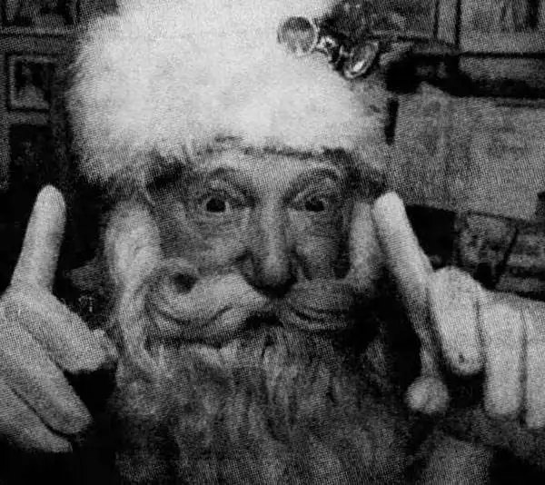
Francis 'Fran' Dowie (1921 - December 21, 2006) was a Canadian performer, actor, cartoonist, vaudevillian, and puppeteer. Born in Richmond, British Columbia, Dowie came from a family of performers, his grandfather, Frank W. Dowie, founded the first minstrel show to perform at London's Palladium in the early 1900s. Dowie began performing at the age of seven with his father Frank in their comedy duo, performing at Vancouver's Orpheum Theatre. From that point on he never stopped. He was a member of a vaudeville troupe during World War II, called 'The Blackouts' and performed for soldiers throughout Canada, Alaska, and all across Europe after the war ended. While performing with 'The Blackouts' Dowie married Candy Kane (1922 - XXXX), who later was forced to return to Canada after she became pregnant. After the war, Dowie directed productions at the Theatre Royal in Barkerville, British Columbia. At the age of sixty-five, instead of retiring, Dowie began performing as Santa Claus for children. He is best remembered for this role and is widely remembered at 'the Lower Mainland's most beloved Santa'. Dowie also became a puppeteer in his later years and was an active member of the Society for the Preservation of Vaudeville. Dowie is a member of the British Columbia Entertainment Hall of Fame and was one of the first selected for a star on the B.C. Hall of Fame's STARWALK.
Londoner's take on the Wild West.
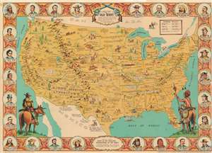
Danny Arnold's Pictorial Map of the Old West Showing pioneer trails and battles, Indian's territories, stagecoach lines, military forts, historical data of the frontier period around 1840.
sold
- Digital Map Information
- Suitable for large format printing
- File Size: 39.6 MB
- File Type: ZIP / TIFF
- ICC color profile embedded
- Delivered instantly via download link
This is a c. 1950 Fran Dowie pictorial map of the United States highlighting American frontier history. Captioned illustrations mark important historical events: Battles during the Indian Wars, acts of frontier justice against outlaws such as Jesse James and Billy the Kid, and the shootout at the O.K. Corral, are just a few of the events noted. Pioneer trails, such as the Oregon Trail, the Santa Fe Trail, and the Pony Express Route, are illustrated as well. The Grand Canyon, the Rocky Mountains, and the Sierra Nevada Mountains evoke the majesty of the rugged terrain. The whole is surrounded by a pictorial border incorporating portraits of frontier personalities: Doc Holliday, Crazy Horse, Jim Bowie, Wyatt Earp, Davy Crockett, and Jesse James. (more details)
Londoner's take on the Wild West.
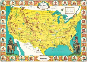
Sheriff Danny Arnold's Pictorial Map of the Old West Showing pioneer trails and battles, Indian's territories, stagecoach lines, military forts, historical data of the frontier period around 1840.
sold
This is a c. 1950 Fran Dowie pictorial map of the United States highlighting American frontier history. Captioned illustrations mark important historical events: battles during the Indian Wars, acts of frontier justice against outlaws such as Jesse James and Billy the Kid, and the shootout at the O.K. Corral, are just a few of the events noted. Pioneer trails, such as the Oregon Trail, the Santa Fe Trail, and the Pony Express Route, are illustrated as well. The Grand Canyon, the Rocky Mountains, and the Sierra Nevada Mountains evoke the majesty of the rugged terrain. The whole is surrounded by a pictorial border incorporating portraits of frontier personalities: Doc Holliday, Crazy Horse, Jim Bowie, Wyatt Earp, Davy Crockett, and Jesse James. (more details)
Londoner's take on the Wild West.
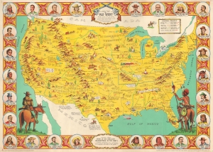
Sheriff Danny Arnold's Pictorial Map of the Old West Showing pioneer trails and battles, Indian's territories, stagecoach lines, military forts, historical data of the frontier period around 1840.
sold
- Digital Map Information
- Suitable for large format printing
- File Size: 45.38 MB
- File Type: ZIP / TIFF
- ICC color profile embedded
- Delivered instantly via download link
This is a c. 1950 Fran Dowie pictorial map of the United States highlighting American frontier history. Captioned illustrations mark important historical events: battles during the Indian Wars, acts of frontier justice against outlaws such as Jesse James and Billy the Kid, and the shootout at the O.K. Corral, are just a few of the events noted. Pioneer trails, such as the Oregon Trail, the Santa Fe Trail, and the Pony Express Route, are illustrated as well. The Grand Canyon, the Rocky Mountains, and the Sierra Nevada Mountains evoke the majesty of the rugged terrain. The whole is surrounded by a pictorial border incorporating portraits of frontier personalities: Doc Holliday, Crazy Horse, Jim Bowie, Wyatt Earp, Davy Crockett, and Jesse James. (more details)
How was the 'West Won'?
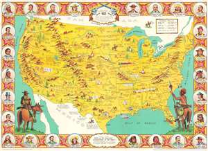
This is a c. 1963 Fran Dowie pictorial map of the United States highlighting U.S. frontier history, or 'How the West was won'. The map was most likely created to cash in on the success of the Cinerama film by the same name. Captioned illustrations mark important historical events and provide context. Important battles during the Indian Wars, acts of frontier justice against outlaws such as Jesse James and Billy the Kid, and the shootout at the O.K. Corral are a few of the events noted. Pioneer trails, such as the Oregon Trail, the Santa Fe Trail, and the Pony Express Route, are illustrated as well. The Grand Canyon, the Rocky Mountains, and the Sierra Nevada Mountains evoke the majesty of the rugged terrain. The whole is surrounded by a pictorial border incorporating portraits of frontier personalities: Doc Holliday, Crazy Horse, Jim Bowie, Wyatt Earp, Davy Crockett, and Jesse James. (more details)