
Edge, Thomas (sold)

Thomas Edge (1587/88 - December 29, 1624) was an English merchant, whaler, and seal hunter who worked for the English Muscovy Company in the first quarter of the 17th century. He went on seal-hunting voyages to Bear Island in 1609 and 1610, and commanded whaling voyages to Svalbard between 1611 and 1619. He recorded the events of his travels in A Brief Discovery of the Northern Discoveries, which would be published posthumously in the 1625 Purchas His Pilgrimes. In large part thanks to the map he produced to accompany his tale, his name survives in the toponymy of the islands. Edgeøya (Edge Island) takes its name from him as did Edge's Point, prior to its renaming as Lægerneset.
Whales, Walruses, Bears … and apparently Ducks.
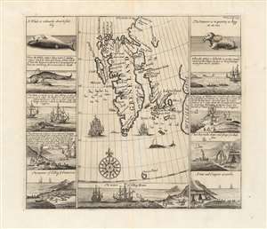
[Greneland / Wiches Lande].
sold
- Digital Map Information
- Suitable for large format printing
- Full resolution TIFF file
- ICC color profile embedded
- Delivered instantly via download link
This is a scarce 1744 Church / Edge map of map of the Arctic Spitzbergen / Svalbard archipelago. The region here represented was the Europe's best whaling and walrusing ground in the 18th century. (more details)