
General Land Office

The General Land Office (GLO) (1812 - 1946) was an independent agency of the United States government responsible for public domain lands in the United States. Created in 1812, it took over functions previously conducted by the Department of the Treasury. The GLO oversaw the surveying, platting, and sale of public lands in the western United States. It also administered the Preemption Act of 1841, which allowed individuals who were already living on federal land to purchase up to 160 acres of land before it was offered for sale to the general public, if they met certain requirements. Following the passage of the Homestead Act in 1862, which was also administered by the GLO, claims under the Preemption Act sharply decreased. The GLO became a part of the newly-created Department of the Interior in 1849. In 1891 Grover Cleveland and Congress created 17 forest reserves, due to public concern over forest conservation, which were initially managed by the GLO, until they were transferred to the Forest Service in 1905. In 1946 the Government Land Office was merged with the United States Grazing Service to become the Bureau of Land Management. Today the Bureau of Land Management administers the roughly 246 million acres of public land remaining under federal ownership.
One of the first maps of Florida as a state.
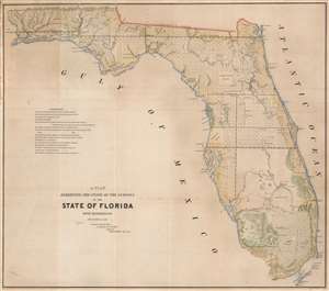
A Plat Exhibiting the State of the Surveys in the State of Florida with References.
$650.00
Acquire
- Digital Map Information
- Suitable for large format printing
- DPI: 600
- File Size: 66.93 MB
- File Type: ZIP / TIFF
- ICC color profile embedded
- Delivered instantly via download link
One of the first (if not the first) maps of Florida after it became a state, this is an 1845 Robert Butler map of Florida illustrating the progress of the Public Land Survey System in the newly admitted state. (more details)
Early platting of Michigan.
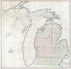
F Sketch of the Public Surveys in Michigan.
$250.00
Acquire
- Digital Map Information
- Suitable for large format printing
- Full resolution TIFF file
- ICC color profile embedded
- Delivered instantly via download link
This is an 1845 General Land Office map of Michigan tracking progress of government surveys in the state. The entire state is divided into townships. Symbols are used to inform on the status of the survey work. For example, work in townships near the Ohio and Indiana border is nearly complete, while surveying in the western portion of the Upper Peninsula had not started. A key explaining the various symbols used to identify survey status appears along the left border. While very little detail is provided apart from the township grid, but Michigan's extensive river network is well illustrated. (more details)
Strained U.S. - American Indian Relations.
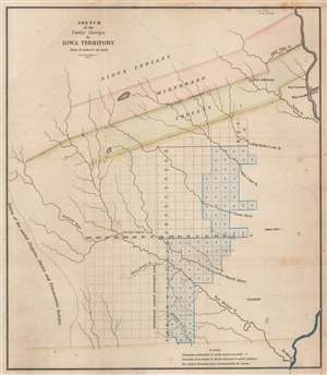
Sketch of the Public Surveys in Iowa Territory.
$200.00
Acquire
- Digital Map Information
- Suitable for large format printing
- Full resolution TIFF file
- ICC color profile embedded
- Delivered instantly via download link
This is an 1845 General Land Office map of the Iowa Territory, covering lands west of the Wisconsin River. The 'Neutral Ground' separating the warring Sioux and Sac and Fox Indian nations dominates the upper map. Fort Atkinson, established to protect the forcibly resettled Winnebago, is labeled within the 'Neutral Ground'. Townships appear below the 'Neutral Ground', and the settlements of Iowa City, Fairfield, and Keokuck are labeled. (more details)
2nd Official Map of Colorado Territory.
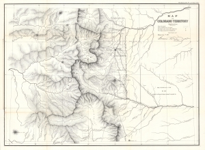
Map of Colorado Territory.
$1,300.00
Acquire
- Digital Map Information
- Suitable for large format printing
- File Size: 17.35 MB
- File Type: ZIP / TIFF
- ICC color profile embedded
- Delivered instantly via download link
This is the 1862 map of the Colorado Territory compiled by Francis M. Case for the General Land Office. It is considered the second official map of the Colorado Territory, following Case's earlier map of 1861. The map comes at the tail end of the Pike's Peak Gold Rush, but early in Colorado's emergence as a territory. (more details)
Irrational Railroad Exuberance.
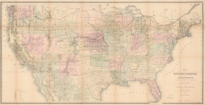
Map of the United States and Territories, Showing the extent of Public Surveys and other details, Constructed from the Plats and official sources of the General Land Office.
$1,000.00
Acquire
- Digital Map Information
- Suitable for large format printing
- Full resolution TIFF file
- ICC color profile embedded
- Delivered instantly via download link
This is an 1870 map of the United States issued by the U.S. General Land Office, led by Commissioner Joseph S. Wilson. Rich in detail, it illustrates the progress of U.S. government land surveys from coast to coast, also reflecting information on mineral deposits, the development of railways, and settlement patterns on the vast American frontier. (more details)
Spanish-Era Land Grants in New Mexico.
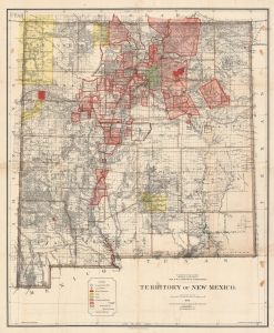
Territory of New Mexico.
$1,200.00
Acquire
- Digital Map Information
- Suitable for large format printing
- File Size: 233.72 MB
- File Type: ZIP / TIFF
- ICC color profile embedded
- Delivered instantly via download link
This is a large and detailed 1896 Robert H. Morton and General Land Office map of the New Mexico Territory. The map highlights private land grants, American Indian reservations, military bases, and forest reserves. Of greatest interest are the illustrated land grants, including the Tierra Amarilla Grant, the Beaubien and Miranda Grant, and the Mora Grant. Other annotations represent private grants that required new boundary surveys, were unconfirmed, or that had been rejected or dismissed by the U.S. government. Yellow areas represent reservations granted to the Jicarilla Apache, the Navajo, the Southern Ute, the Zuni, and the Mescalero Apache. (more details)
Alaska near the height of the Klondike Gold Rush.
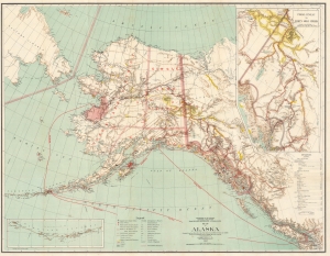
Map of Alaska.
$450.00
Acquire
- Digital Map Information
- Suitable for large format printing
- File Size: 51.18 MB
- File Type: ZIP / TIFF
- ICC color profile embedded
- Delivered instantly via download link
This 1898 Matthew Hendges map of Alaska captures the region near the height of the Klondike Gold Rush. Frontier gold rushes are an integral part of American history of the 19th century and, even today, capture the imagination of those hoping to strike it rich. (more details)
Making Yellowstone accessible - the early years.
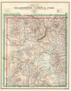
Yellowstone National Park Compiled from the official Records of the General Land Office, U.S. Geological Survey and other sources under the direction of I.P. Berthrong Chief of Drafting Division G. L. O. 1908.
$600.00
Acquire
- Digital Map Information
- Suitable for large format printing
- File Size: 44.55 MB
- File Type: ZIP / TIFF
- ICC color profile embedded
- Delivered instantly via download link
This is a 1908 General Land Office map of Yellowstone National Park, compiled and drawn by Ithamar Berthrong, who produced many important maps of the West during his tenure with the Land Office. The map records the ongoing infrastructure work, begun in 1903, to make the expansive park more manageable and accessible to visitors. (more details)