
Gerson, Albert (sold)

Albert Gerson (January 23, 1903 - March 9, 1977) was a Jewish Russian-American lithographic job printer and inventor based in New York in the mid-20th century. The place of his birth is something of a mystery. Documents predating 1930, list his birthplace as Russia. After 1930, including on his 1942 World War II draft card, his birthplace is listed as Brooklyn. During the 1920s he worked as a millinery salesman, but by 1930, he established his own printing concern, Gerson Offset Lithography. In 1960, Gerson invented the Gerson Multiplater - a labor saving machine for making photo-offset lithograph plates. In 1924, he married Cecelia Schwehel (1924 - 1972).
First edition of an iconic pictorial map.
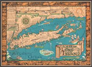
A Map of Long Island.
sold
- Digital Map Information
- Suitable for large format printing
- File Size: 39.69 MB
- File Type: ZIP / TIFF
- ICC color profile embedded
- Delivered instantly via download link
This is a charming 1933 first edition pictorial map of Long Island by Courtland Smith. This historical map covers from New London in Connecticut and Fishers Island south as far as the Lower New York Bay and Staten Island. Long Island is depicted in its entirety from Brooklyn and Queens east to Montauk. Throughout, the map notes cities, towns, beaches, radio stations, parks, ferry lines, lighthouses and several other important landmarks, scenes, and activities. Several landmarks have been attractively illustrated, including the Montauk Point Light, Fire Island Light, Southampton, Coney Island, etc. Gardiner's Island - 'here Capt. Kidd buried loot' and Oyster Park - 'Burial Place of Theodore Roosevelt' are noted. When Smith died, the mayor of Southampton remarked about this map:
That map has had a significant impact on the development of not only Southampton, but all the other towns on Long Island that it features.(more details)
First edition of an iconic pictorial map.
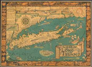
A Map of Long Island.
sold
- Digital Map Information
- Suitable for large format printing
- File Size: 56.89 MB
- File Type: ZIP / TIFF
- ICC color profile embedded
- Delivered instantly via download link
This is a charming 1933 first Gerson edition pictorial map of Long Island by Courtland Smith. This historical map covers from New London in Connecticut and Fishers Island south as far as the Lower New York Bay and Staten Island. Long Island is depicted in its entirety from Brooklyn and Queens east to Montauk. Throughout, the map notes cities, towns, beaches, radio stations, parks, ferry lines, lighthouses and several other important landmarks, scenes, and activities. Several landmarks have been attractively illustrated, including the Montauk Point Light, Fire Island Light, Southampton, Coney Island, etc. Gardiner's Island - 'here Capt. Kidd buried loot' and Oyster Park –'Burial Place of Theodore Roosevelt' are noted. When Smith died, the mayor of Southampton remarked about this map:
That map has had a significant impact on the development of not only Southampton, but all the other towns on Long Island that it features.(more details)