
Gibbes, Charles Drayton (sold)

Charles Drayton Gibbes (1813 – May 25, 1893) was an American civil engineer, publisher, surveyor, and cartographer active in California during the latter part of the 19th century. The son of a wealthy South Carolina plantation owner and the cousin of Mrs. John Jacob Actor. Gibbes relocated to California with the first wave following the 1848 discovery of Gold at Sutter's Mill. His goal was not to mine gold, but to follow the miners and survey gold discoveries in the region. He published a number of important maps relating to the Gold Rush, including the 1851 New Map of the Gold Region in California and Map of the Southern Mines. He later partnered with publisher Warren Holt to produce an important sequence of large format maps of California issued between 1869 and 1878. After a long and distinguished career as a California surveyor and civil engineer, Gibbes took a position as curator of mineralogy at the California Academy of Sciences in San Francisco.
No amount of time spent on this map would be wasted; its detail is fascinating. - Wheat

Map of the States of California and Nevada. Carefully Compiled from the Latest Authentic Sources. By Chas. Drayton Gibbes, C.E.
sold
- Digital Map Information
- Suitable for large format printing
- File Size: 44.84 MB
- File Type: ZIP / TIFF
- ICC color profile embedded
- Delivered instantly via download link
A beautiful and rare variant on the first edition second state of Warren Holt and Charles Drayton Gibbes' 1873 map of California and Nevada, considered to be one of the finest large-scale maps of California to appear in the second half of the 19th century. The map ... (more details)
No amount of time spent on this map would be wasted; its detail is fascinating. - Wheat
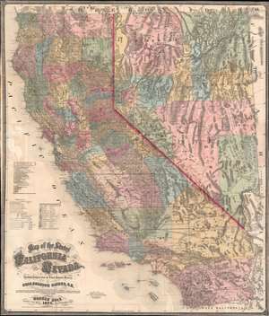
Map of the States of California and Nevada. Carefully Compiled from the Latest Authentic Sources. By Chas. Drayton Gibbes, C.E.
sold
- Digital Map Information
- Suitable for large format printing
- File Size: 95.74 MB
- File Type: ZIP / TIFF
- ICC color profile embedded
- Delivered instantly via download link
A beautiful and rare variant on the first edition second state of Warren Holt and Charles Drayton Gibbes' 1873 map of California and Nevada. This map considered to be one of the finest large-scale maps of California to appear in the second half of the 19th century. Depicting all of California and Nevada, the map offers exceptional detail throughout. To the left, a key identifies 14 Federal Land Districts, 20 California Judicial Districts, and 9 Nevada Counties. The key, which was inherited from the first edition first state, is somewhat out of sync with the updated second state, which adds Eureka County, Nevada. Additional coding identifies 10, 20, and 30 mile railroad grants to the Central Pacific, Western Pacific, C. and O., Southern Pacific, P. and S., S. and C., and A. and P. Railroads. (more details)