
Girard, Xavier (sold)

Xavier Girard (fl. c. 1820 - 1844) was a French cartographer known for publishing a series of city maps or plans of Paris from 1820 until at least 1844.
An extremely rare linen-backed city map or plan of Paris.
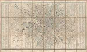
Plan de la Ville de Paris Divisé en 12 Arrondissemens, et 48 Quartiers. Indiquant tous les Changemens faits et Projetés.
sold
- Digital Map Information
- Suitable for large format printing
- DPI: 300
- File Size: 37.85 MB
- File Type: ZIP / TIFF
- ICC color profile embedded
- Delivered instantly via download link
This is an 1844 Xavier Girard city map or plan of Paris, France. The map depicts the city from the Arc de Triomphe to the Place de la Nation (labeled here as the Place du Trône) and from the village of Montmartre to the Place d'Italie. Incredibly detailed, nearly ... (more details)