
Heitor, António (sold)

António Heitor (18?? - 18??) was a Portuguese surveyor, engineer, and public servant active in Asia in the late 19th century. Heitor was the Secção de Obras Pública in Timor, where he led the survey to delimitate the border with Dutch Timor. He was also active in Macau. There is another of the same name that we find in Brazil, although it is unclear if they are related.
Chinese and Portuguese Macau.
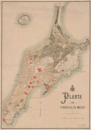
Planta de Peninsula de Macau.
sold
- Digital Map Information
- Suitable for large format printing
- File Size: 34.81 MB
- File Type: ZIP / TIFF
- ICC color profile embedded
- Delivered instantly via download link
A rare 1889 large-scale chromolithograph map of Macau, China, by António Heitor and the Sociedade de Geografia de Lisboa. This map follows the 1887 Sino-Portuguese Treaty, considered one of the Unequal Treaties following the Opium Wars, which granted the Portuguese full sovereignty over Macau. The map can be divided into two sections, the Chinese community and village in the northeastern quadrant, here colored grey and full of farm fields, and the Portuguese urbanization encroaching from the south. Episcopal buildings, fortifications, and civil institutions are highlighted in red. (more details)