
Hennenberger, Caspar (sold)

Caspar Hennenberger (1529 – February 29, 1600) was a German Lutheran pastor, historian and cartographer. He was born in Erlich, in Thüringen; he started his studies in Lutheran divinity at the University of Königsberg in 1550, and he would work for nearly thirty years as a Lutheran Pastor. His scholarship apparently reached beyond divinity, however: with the support of his patron Duke Albert of Prussia, and the aid of Prussian mathematician Nicolaus Neodomus, Hennenberger would produce, and in 1576 publish, the first detailed map of Prussia. He accompanied that work with several books amplifying on the map. Hennenberger's map would be well received: Abraham Ortelius would adopt Hennenberger's map as a model, replacing the outdated map derived from Heinrich Zell's 1542 work.
Ortelius' corrected version of the first detailed map of Prussia.
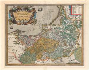
Prussiae Vera Descriptio Per Gaspar Henneberg Erlichens.
sold
- Digital Map Information
- Suitable for large format printing
- DPI: 600
- File Size: 53.76 MB
- File Type: ZIP / TIFF
- ICC color profile embedded
- Delivered instantly via download link
A beautiful, original-color first atlas edition of Ortelius' third map of Prussia, added to the Theatrum Orbis Terrarum in 1595. It depicts the region now comprised of northern Poland (as far south as Toruń on the Vistula River), the Russian province of Kaliningrad, and western Lithuania. Detail spans from just west of Gdansk to Augustów in the east. The northeast limits of the map are marked with the region of Samogitia, and the Lithuanian coastal town of Palanga. (more details)