
Henriot, J. N. (sold)

J. N. Henriot (fl. c. 1849 -1871) was a Paris based engraver and printer. Henriot worked in conjunction with A. Bes and F. Dubreuil, as well as other publishing firms of the day, to produce a number of widely distributed and popular maps of Paris and its environs. Like many French engravers of this period, little is known of his personal life and work.
Shows Haussmann's modernization of Paris.
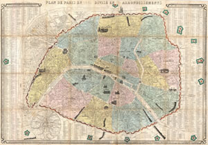
Plan de Paris en 1861 Divise en 20 Arrondissements.
sold
- Digital Map Information
- Suitable for large format printing
- File Size: 35.71 MB
- File Type: ZIP / TIFF
- ICC color profile embedded
- Delivered instantly via download link
A highly appealing 1861 tourist pocket map of Paris by J. N. Henriot. Covers the walled center of Paris as well as the immediate environs including the 14 ring forts. Reflects the transformation and modernization of Paris under Napoleon III and Georges-Eugène ... (more details)
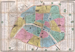
Plan de Paris en 1863 Divise en 20 Arrondissements.
sold
- Digital Map Information
- Suitable for large format printing
- File Size: 33.15 MB
- File Type: ZIP / TIFF
- ICC color profile embedded
- Delivered instantly via download link
This is an extremely attractive 1863 tourist pocket map of Paris, France. Covers the old walled city of Paris and the immediate vicinity. Divided up into 20 arrondissments. Important buildings are shown in profile. Trains entering and leaving the city are ... (more details)
Includes charming vignettes of trains entering and leaving the city.
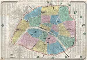
Plan de Paris en 1864 Divisé en 20 Arrondissements.
sold
- Digital Map Information
- Suitable for large format printing
- File Size: 23.57 MB
- File Type: ZIP / TIFF
- ICC color profile embedded
- Delivered instantly via download link
This is an 1864 J. N. Henriot city map or plan of Paris France. The map depicts the city from the Basilica of St. Denis (Abbaye de St. Denis) to the Fort de Bicêtre and from the Bois de Boulogne to the Fort de Nogent and the Fot de Rosny. Paris is divided ... (more details)