
Herbert, William (sold)
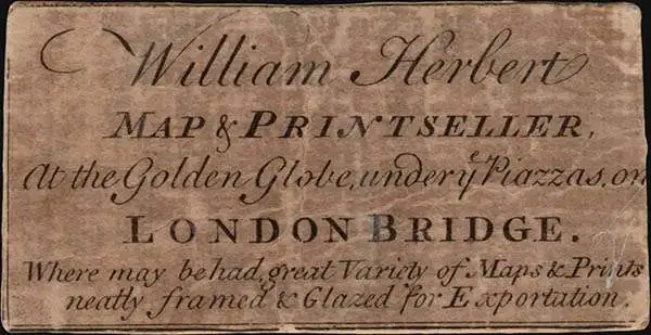
William Herbert (November 29, 1718 – March 18, 1795) was a British map seller, book seller, publisher, and surveyor based in London in the second half of the 18th century. Herbert was born in London, the son of a dyer and hosier of Gravel Lane. He signed on to the East India company in 1738 as a purser's clerk, traveling in the process to the colonies in India. He returned to London in about 1745, having amassed a considerable collection of manuscript plans and charts of East India ports. Recognizing their commercial value, he set up business as a map and print seller on London Bridge in 1748. The premises of this business were sadly destroyed while Herbed watched the April 11, 1759 London Fire. He published a number of maps as well as the important New Directory for the East Indies. Much of his most important cartographic work seem to be associated with William Nichelson, who traveled to the East Indies in the 1750s and 60s mapping ports on behalf of the EOC. He retired in 1776 in reasonable comfort. His publications continued to be updated and re-published by his successors, among them Samuel Dunn and Henry Gregory.
1779 William Herbert Map of the Pirate Refuge of Ile Sainte-Marie (Libertalia / Nosy Boraha), Madaga
Exceptional English map of the Legendary Pirate republic of Libertalia where Kidd's galley, the Adventure, was recently discovered.
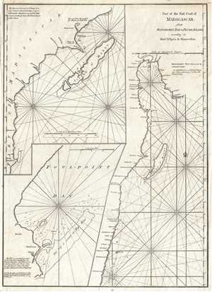
Part of the East Coast of Madagascar from Manghabey Bay to Plumb Island according to Mons. D'Apres de Mannevillette.
sold
- Digital Map Information
- Suitable for large format printing
- Full resolution TIFF file
- ICC color profile embedded
- Delivered instantly via download link
One of the most enjoyable maps we have had the privilege of cataloging, this is William Herbert's map of the island of Île Sainte-Marie, St. Mary's Island, or as it is known today, Nosy Boraha, Madagascar. During the 17th and 18th centuries Île Sainte-Marie ... (more details)