
Hogg, Alexander (sold)

Alexander Hogg (fl. c. 1778-1824) was a London based book, map, and print publisher. Hogg is best known for his publication of the journals of James Cook, but he also published a number of local plans focusing on the British Isles. His offices were based at no. 16 Paternoster Row, London, England.
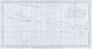
A Chart of the Islands discovered in the Neighbourhood of Otaheite, in the Course of Several Voyages round the World Made by the Capts. Byron, Wallis, Carteret, & Cook.
sold
- Digital Map Information
- Suitable for large format printing
- DPI: 300
- File Size: 1.25 MB
- File Type: ZIP / TIFF
- ICC color profile embedded
- Delivered instantly via download link
This is a rare map of the Society Islands in the South Pacific published by Alexander Hogg to illustrate the voyages and discoveries of the sea captains Byron, Wallis, Carteret ad Cook. This map contains references to the cartographic work of John Hawkesworth ... (more details)
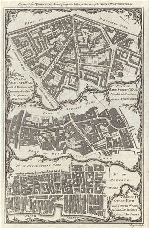
Plan of Aldgate Ward with its Divisions into Precints and Parishes from a New Survey. Plan of Lime Street Ward Divided into Parishes from a new Survey. Plan of Queen Hith and Vintry Wards Divided into Parishe, from a New Survey.
sold
- Digital Map Information
- Suitable for large format printing
- DPI: 300
- File Size: 5.32 MB
- File Type: ZIP / TIFF
- ICC color profile embedded
- Delivered instantly via download link
An uncommon and appealing c. 1780 ward plan of parts of London, England, by Alexander Hogg. Essentially three maps in one, this chart covers, from top down Aldgate Ward, Lime Street Ward, and Queen Hith and Vintry Wards. The Aldgate Map is centered on ... (more details)
Giving hope to the revolutionary cause.
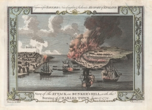
View of the Attack on Bunker's Hill, with the Burning of Charles Town, June 17, 1775.
sold
- Digital Map Information
- Suitable for large format printing
- DPI: 600
- File Size: 16.6 MB
- File Type: ZIP / TIFF
- ICC color profile embedded
- Delivered instantly via download link
One of the earliest obtainable views of the 1775 American Revolutionary War (1775 - 1783) Battle of Bunker Hill. Published in 1783, this view illustrates the June 17, 1775, Battle of Bunker Hill, near Boston, one of the first and most significant battles of the war. (more details)
Charting Cook's travels along the Alaska coast.
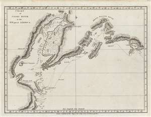
Chart of Cooks River in the N.W. part of America.
sold
- Digital Map Information
- Suitable for large format printing
- DPI: 600
- File Size: 14.04 MB
- File Type: ZIP / TIFF
- ICC color profile embedded
- Delivered instantly via download link
An important c. 1784 nautical chart or map of the Cook Inlet and Prince William Sound along the Kenai Peninsula, just south of Anchorage, Alaska. It was the product of the third and final Pacific voyage of Captain James Cook, and was published in George William Anderson and Alexander Hogg's A New, authentic, and complete collection of voyages round the world, undertaken and performed by royal authority.... (more details)