
Holt, Renfrew, and Company (sold)

A promotional map published by Holt, Renfrew, and Company, a high-end Canadian department store.
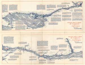
Canada's Scenic and Storied St. Lawrence. Part I: Niagara to Montreal. / Canada's Scenic and Storied St. Lawrence. Part II: Montreal to Saguenay.
sold
- Digital Map Information
- Suitable for large format printing
- File Size: 27.63 MB
- File Type: ZIP / TIFF
- ICC color profile embedded
- Delivered instantly via download link
This is a 1921 Holt, Renfrew, and Company map of the Saint Lawrence River. Divided into two parts, the first map depicts the St. Lawrence River from Hamilton, Ontario to Montreal and from the Lake of the Two Mountains, to Buffalo, New York, while the second depicts the river from Montreal to the Saguenay River and Tadousac and from Ste Anne to Lake Champlain. Myriad cities and towns all along the river are labeled, including Toronto, Montreal, and Quebec, along with Niagara Falls, Buffalo, Rochester, Oswego, and Three Rivers. Text boxes are scattered along both banks of the river in both parts and offer historical information about the cities and towns along the river's course, although islands, rivers, and bridges are also among the highlighted locations. (more details)