
Hopkins, Griffith Morgan (sold) (George M. Hopkins, G. M. Hopkins)

Griffith Morgan Hopkins (George M. Hopkins, G. M. Hopkins; 1834 - September 23, 1901) was an American Civil Engineer active in Philadelphia. Hopkins was born in Camden, New Jersey, and spent most of his career in Philadelphia. His earliest known map is the 1859 Clark and Tackabury map of Connecticut. He is also credited with work on the well-known Kitchell map of New Jersey (1860). In 1865, he partnered with his brother, Henry W. Hopkins (1838 - 1920), to found G.M. Hopkins and Company. This prosperous firm issued numerous plat maps and atlases of American cities and counties, most along the eastern seaboard. Hopkins retired from the firm in 1901 and died one year later. The firm was taken over by his brother, Henry, who himself retired in 1902. G. M. Hopkins went through numerous subsequent owners and remains active to this day.
AKA: George M. Hopkins, G. M. Hopkins
The largest and most detailed map of New Jersey to appear in the 19th century - a seminal production.
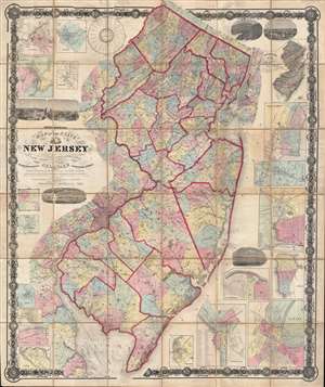
Topographical map of the State of New Jersey together with the vicinities of New York and Philadelphia, and with most of the state of Delaware from the State Geological Survey and the U.S. Coast Survey, and from surveys by G. Morgan Hopkins, civil engineer.
sold
- Digital Map Information
- Suitable for large format printing
- File Size: 166.59 MB
- File Type: ZIP / TIFF
- ICC color profile embedded
- Delivered instantly via download link
Magnificently detailed, visually stunning, and monumentally proportioned, this is William Kitchell's seminal 1860 case map of New Jersey. Dissected and mounted on thirty-six linen backed panels, this map covers the entire state of New Jersey as well as the ... (more details)
The largest and most detailed map of New Jersey to appear in the 19th century - a seminal production.
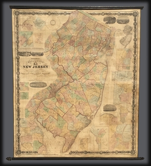
Topographical map of the State of New Jersey together with the vicinities of New York and Philadelphia, and with most of the state of Delaware from the State Geological Survey and the U.S. Coast Survey, and from surveys by G. Morgan Hopkins, civil engineer.
sold
Magnificently detailed, visually stunning, and monumentally proportioned, this is William Kitchell's seminal 1860 wall map of New Jersey. This is the largest map of New Jersey printedi n the 19th century. Mounted on linen with rollers, this map covers the ... (more details)