
Horsley, John (sold)

John Horsley (1685 - 1732) was a Scottish Presbyterian minister and antiquarian active in the early 18th century. Horsely is best known for his publication of a three-volume study on Roman Antiquities in Britain in 1732. He created several important maps of England on Roman Times. Horsely is also known for his invention of a device for measuring rainfall, for which he was awarded membership in the Royal Society.
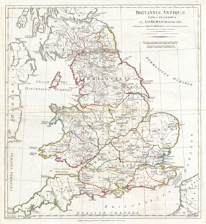
Britanniae Antiquae Tabula Geographica ex. Evi Romani Monumentis…
sold
- Digital Map Information
- Suitable for large format printing
- DPI: 300
- File Size: 14.24 MB
- File Type: ZIP / TIFF
- ICC color profile embedded
- Delivered instantly via download link
A large and dramatic 1794 map of England under Roman Rule. Covers all of England (Province of Britanniae) as well as adjacent parts of Scotland, Ireland (Hibernia), and France (Gallia). Features both ancient and contemporary place names, ie. Londinium and ... (more details)