
Hydrographic Office United States Navy

United States Hydrographic Office (1866 - 1962) was a brach of he U.S. Navy that prepared and published maps, charts, and nautical books to aid in navigation. Before the establishment of the Hydrographic Office in 1866, U.S. navigators were almost entirely dependent on British charts. There had been a few private enterprises that had prepared and published charts, but none had been able to do so profitably. The Office was established 'for the improvement of the means of navigating safely the vessels of the Navy and of the mercantile marine, by providing, under the authority of the Secretary of the Navy, accurate and cheap nautical charts, sailing directions, navigators, and manuals of instructions for the use of all vessels of the United States, and for the benefit and use of navigators generally.' This way the Navy Department could furnish navy and merchant ships with charts illustrating the results of surveys and explorations undertaken by naval officers. The charts were priced to cover the cost of paper and printing alone, not preparation. Its main objective was to survey foreign coasts, as the Coast and Geodetic Surveys were responsible for surveying domestic waters. The Hydrographic Office was transferred from the Department of the Navy to the Department of Defense in 1949 and was replaced by the Naval Oceanographic Office in 1962.
Groundbreaking infographic chart of the East African Coast / Western Indian Ocean.
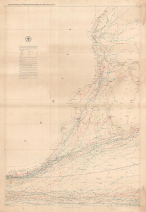
Maury's Wind and Current Chart Series A, Indian Ocean No. 4.
$800.00
Acquire
- Digital Map Information
- Suitable for large format printing
- Full resolution TIFF file
- ICC color profile embedded
- Delivered instantly via download link
A colorful 1854 Matthew Fontaine Maury nautical map of the eastern coast of Africa, from Kenya to South Africa. Matthew Fontaine Maury, the greatest American hydrographer of his time, produced it, and like all his wind and current charts, it is a marvel of infographic mapping. (more details)
Manuscript highlighting of hazards in the Rio de la Plata.
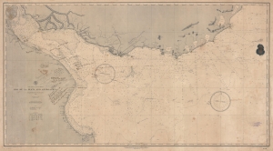
East Coast of South America. Rio de la Plata and Approaches.
$750.00
Acquire
- Digital Map Information
- Suitable for large format printing
- File Size: 83.98 MB
- File Type: ZIP / TIFF
- ICC color profile embedded
- Delivered instantly via download link
A fascinating working nautical chart, this is an 1888 U.S. Navy Hydrographic Office map of the Rio de la Plata, South America. The map features manuscript annotations following several voyages detailing lights and hazards. It offers unique insight into the navigation of one of the world's most famous estuaries. (more details)
Last Days of the Age of Sail.
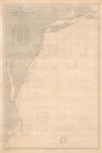
North America Atlantic Coast of the United States Buzzard's Bay to Cape Lookout.
$1,500.00
Acquire
- Digital Map Information
- Suitable for large format printing
- File Size: 73.45 MB
- File Type: ZIP / TIFF
- ICC color profile embedded
- Delivered instantly via download link
This is a rare large-format 1890 nautical chart of the Atlantic Coast of the United States prepared by the U.S. Hydrographic Office. Among other interesting features, the chart has a very clear provenance, having been purchased by Captain Thomas R. Anderson for use aboard the ship Albania. (more details)
Detailed chart of Mexico's largest port!
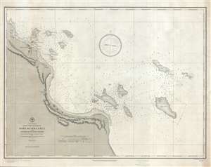
Port of Vera Cruz and Anchorage of Anton Lizardo.
$450.00
Acquire
- Digital Map Information
- Suitable for large format printing
- File Size: 17.31 MB
- File Type: ZIP / TIFF
- ICC color profile embedded
- Delivered instantly via download link
This is an 1891 U.S. Navy Hydrographic Office nautical chart or maritime map of the port of Veracruz, Mexico and the anchorage of Anton Lizardo. The map depicts the coastline of Mexico from Point Gorda to Anton Lizardo and further south. Several points along the ... (more details)
Air route from San Francisco to Auckland.
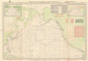
Pilot Chart of the Upper Air - North Pacific Ocean.
$300.00
Acquire
- Digital Map Information
- Suitable for large format printing
- Full resolution TIFF file
- ICC color profile embedded
- Delivered instantly via download link
This is a March 1938 U.S. Navy Hydrographic Office aeronautic map of the North Pacific detailing prevailing winds. Wind roses indicate what the wind at the surface averaged over 100 hours. Boxes on the left and right sides provide average wind readings at 2,500 feet, 5,000 feet, and 10,000 feet above major cities of the Pacific Rim, including Shanghai, Hong Kong, Manila, Seattle, Los Angeles, and San Diego. Red lines trace air routes, including the famed China Clipper route from San Francisco to Hong Kong via Honolulu, Midway, Wake, Guam, and Manila. An inset in the upper left presents isobars and isotherms for March 1938 and an inset in the upper right details gales for the month of March. Explanatory information occupies most of the upper right. (more details)
Manuscript notations reference a pre-WWII Navy War College war game.
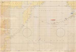
No. 5050, Strategic Plotting Chart No. 4.
$400.00
Acquire
- Digital Map Information
- Suitable for large format printing
- File Size: 44 MB
- File Type: ZIP / TIFF
- ICC color profile embedded
- Delivered instantly via download link
This is a 1939 U.S. Navy Hydrographic Office chart of the Aleutian Islands and the North Pacific, with WWII Era manuscript annotations. Coverage extends from Siberia, Sakhalin, and northern Japan to Bristol Bay and southwestern Alaska. (more details)
Defending America's Maritime Frontiers.
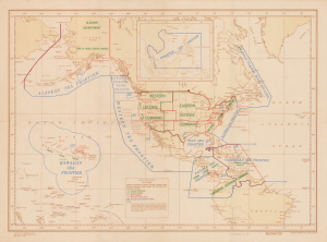
(Special COMINCH) H.O. Misc. 10,194.
$400.00
Acquire
- Digital Map Information
- Suitable for large format printing
- Full resolution TIFF file
- ICC color profile embedded
- Delivered instantly via download link
This is an unrecorded 1945 U.S. Navy Hydrographic Office map of the Americas, delineating the territory of different U.S. Navy Sea Frontiers. These zones were critical components of the U.S. war effort, securing America's coastline and shipping lanes throughout the Atlantic and Pacific Oceans. (more details)
Training U.S. Navy pilots after World War II.
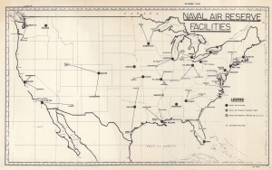
Naval Air Reserve Facilities.
$150.00
Acquire
- Digital Map Information
- Suitable for large format printing
- File Size: 12.44 MB
- File Type: ZIP / TIFF
- ICC color profile embedded
- Delivered instantly via download link
This is an October 1949 U.S. Navy Hydrographic Office map of the United States marking U.S. Naval Air Reserve bases across the United States. It sheds light on the U.S. Naval training following World War II (1939 - 1945). (more details)