
India Quartermaster General Office (sold)

India Quartermaster General Office (1803 - 1947), a major branch of the QMG, was the division of the British Indian Army responsible for logistics and mapping. Among other duties, the QMG employed detachments of military engineers to conduct and compile surveys of conflict theaters. The QMG was based in Calcutta, but established several annex branches, in Simla (Himachal Pradesh, India), Colombo, and elsewhere. Master cartographers, surveyors, and draftsmen under the QMG traveled throughout British India and the adjacent regions, compiling detailed surveys in anticipation of trade, war, or both. Working in diverse and sometimes onerous conditions, they developed sophisticated cartographic conventions while at the same time adapting to local supplies and resources. Some, for example, have noted the QMG maps often have resplendent bright color - these are palettes adapted from Indian handmade watercolors traditionally used in the Bengali textile industry. These attractive colors were later adapted into the general British cartographic palette. Few QMG maps were ever published, most surviving only in manuscript, in institutional archives like the British Library’s India Office Records. Moreover, despite their significance, no comprehensive survey of surviving of India QMG maps has been compiled, resulting in their being generally underappreciated and misunderstood. The QMG remained active in India until the British withdraw in 1947.
Map of Kabul that traverses both Anglo-Afghan Wars and embodies The Great Game.
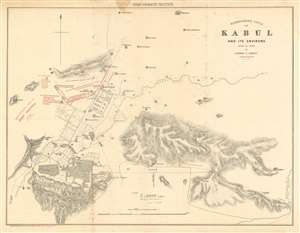
Reconnaissance Sketch of Kabul and its Environs made in 1842 by Captain F. Abbott Bengal Engineers.
sold
- Digital Map Information
- Suitable for large format printing
- File Size: 19.77 MB
- File Type: ZIP / TIFF
- ICC color profile embedded
- Delivered instantly via download link
This is an 1879 Quartermaster General's Office (QMG) and Royal Engineer Institute city plan or map of Kabul, Afghanistan and environs published during the Second Anglo-Afghan War (1878–1880) to illustrate the 1879 Siege of the Sherper Cantonment. This map is cartographically derived from an earlier survey completed in 1842 during the First Anglo-Afghan War under Captain Frederick Abbott of the 1842 Kabul Expedition. General Pollack's camp established during the 1842 Kabul Expedition is marked by a flag. (more details)
The largest and best map of Persia.
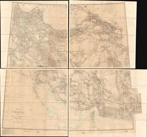
Map of Persia (in Six Sheets) Compiled in the Simla Drawing Office Survey of India.
sold
- Digital Map Information
- Suitable for large format printing
- File Size: 54.87 MB
- File Type: ZIP / TIFF
- ICC color profile embedded
- Delivered instantly via download link
This massive, six-sheet map of Persia produced in 1897 by the British Survey of India (updated to 1902) was the most detailed map of what is now Iran, Iraq, and parts of Azerbaijan and Turkmenistan that had been executed to date: we are aware of no comparable map prior. Its exhaustive detail would continue to command respect well into the 20th century: the German military faithfully copied this map in 1918, as they did with other British maps of important theaters in the Great War. (more details)
Resplendent primary-source manuscript illustrating the Kandahar theater fo the First Anglo-Afghan War.
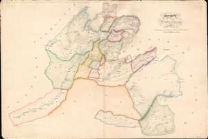
Districts of Kundahar 1840.
sold
- Digital Map Information
- Suitable for large format printing
- DPI: 600
- File Size: 26.75 MB
- File Type: ZIP / TIFF
- ICC color profile embedded
- Delivered instantly via download link
An exquisitely drafted manuscript map of the Kandahar Region, Afghanistan, during the First Anglo-Afghan War (1839 - 1942). Resplendently drafted and colored by the Indian Quartermaster General's Office (QMG), the map incorporates traditional Bengali handmade inks. During this conflict, Kandahar was the most important British base in Afghanistan, and the surrounding region was a theater of fierce and constantly evolving guerrilla war. The present map is the result of direct field mapping, completed under onerous war-footing, yet nonetheless represents one of the earliest broadly accurate maps of the Kandahar region. The map is roughly centered on the city of Kandahar and presents a stellar overview of the surrounding region, extending from Girishk and the Helmand Valley, in the west, to Qalati Giliji, in the east, covering parts of the modern Afghan provinces of Helmand, Kandahar, Uruzgan and Zabol. It is, moreover, one of very few surviving original manuscript maps from First Anglo-Afghan War, the first (not the last) major western foray into Afghanistan. (more details)