
Jaillot, Alexis-Hubert
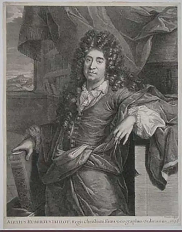
Alexis-Hubert Jaillot (c. 1632 - 1712) followed Nicholas Sanson (1600 - 1667) and his descendants in ushering in the great age of French Cartography in the late 17th and 18th century. The publishing center of the cartographic world gradually transitioned from Amsterdam to Paris following the disastrous inferno that destroyed the preeminent Blaeu firm in 1672. Hubert Jaillot was born in Franche-Comte and trained as a sculptor. When he married the daughter of the Enlumineur de la Reine, Nicholas I Berey (1610 - 1665), he found himself positioned to inherit a lucrative map and print publishing firm. When Nicholas Sanson, the premier French cartographer of the day, died, Jaillot negotiated with his heirs, particularly Guillaume Sanson (1633 - 1703), to republish much of Sanson's work. Though not a cartographer himself, Jaillot's access to the Sanson plates enabled him to publish numerous maps and atlases with only slight modifications and updates to the plates. As a sculptor and an artist, Jaillot's maps were particularly admired for their elaborate and meaningful allegorical cartouches and other decorative elements. Jaillot used his allegorical cartouche work to extol the virtues of the Sun King Louis IV, and his military and political triumphs. These earned him the patronage of the French crown who used his maps in the tutoring of the young Dauphin. In 1686, he was awarded the title of Geographe du Roi, bearing with it significant prestige and the yearly stipend of 600 Livres. Jaillot was one of the last French map makers to acquire this title. Louis XV, after taking the throne, replaced the position with the more prestigious and singular title of Premier Geographe du Roi. Jaillot died in Paris in 1712. His most important work was his 1693 Le Neptune Francois. Jalliot was succeeded by his son, Bernard-Jean-Hyacinthe Jaillot (1673 - 1739), grandson, Bernard-Antoine Jaillot (???? – 1749), and the latter's brother-in-law, Jean Baptiste-Michel Renou de Chauvigné-Jaillot (1710 - 1780).
A Grand North America with California as an island and a speculative Great Lakes.
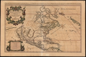
Amerique septentrionale divisée en ses principales parties, ou sont distingués les vns des autres les estats suivant qu'ils appartiennent presentemet aux Francois, Castillans, Anglois, Suedois, Danois, Hollandois, tirée des relations de toutes ces nations par le S. Sanson, geographe ordinaire du roy. 1692.
$3,000.00
Acquire
- Digital Map Information
- Suitable for large format printing
- File Size: 45.47 MB
- File Type: ZIP / TIFF
- ICC color profile embedded
- Delivered instantly via download link
This is Alexis-Hubert Jaillot's impressive and scarce 1692 map of North America. The map offers much of interest, including a bold presentation of California as an Island, evidence of otherwise unpublished preliminary data from the 1673 Marquette-Joliett Expedition of the upper Mississippi watershed, a hopeful open-ended mapping of the western Great Lakes, and a large apocryphal freshwater sea in Appalachia. (more details)
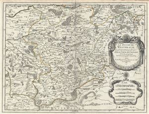
Le Duche de Westphalie ainsi qu'il est presentement possede par L'Eslecteur De Cologne.
$550.00
Acquire
- Digital Map Information
- Suitable for large format printing
- DPI: 300
- File Size: 15.23 MB
- File Type: ZIP / TIFF
- ICC color profile embedded
- Delivered instantly via download link
This is a fine 1681 map of Westphalia, Germany by Alexis-Hubert Jaillot. It covers the Westphalia region in northwest Germany from Hamm south to Ferndorf and from Wipperfurth east as far as Menne. The map renders the entire region in extraordinary detail offering ... (more details)
Classic Dutch World, updated French Cartography.
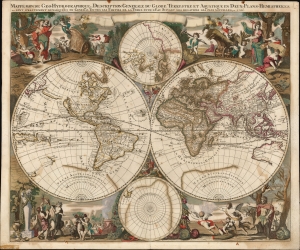
Mappe-Monde Geo-Hydrographique, ou Description Generale Du Globe Terrestre et Aquatique En Deux-Plans-Hemispheres
$6,500.00
Acquire
- Digital Map Information
- Suitable for large format printing
- File Size: 28.15 MB
- File Type: ZIP / TIFF
- ICC color profile embedded
- Delivered instantly via download link
This is a striking, original color example of Gerard Valk's classic 1686 double hemisphere map of the world. The map combines the aesthetics of the Dutch Golden Age with the superior French cartography of Nicolas Sanson. (more details)
Correcting the Zambezi. First Amsterdam edition.
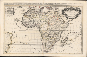
L'Afrique distinguée en ses principales parties, sçavoir La Barbarie, Le Biledulgerid, L'Egypte, Le Saara ou le Desert, Le Pays des Negres, La Guinee, La Nubie, L Abissinie, Le Zanguebar, Le Congo, Le Monomotapa, Les Cafres, Les Iles de Canarie, du Cap-Verd, de St.Thomas, L'Isle Dauphine, autrement Madagascar, ou sont remarqués les Empires, Monarchies, Royaumes, Estats, et peuples qui partagent presentement L'Afrique.Tiré sur les Relations les plus nouvelles. Par le Sr. Sanson, Geographe ordre. du Roy.
$1,800.00
Acquire
- Digital Map Information
- Suitable for large format printing
- DPI: 600
- File Size: 1120.48 MB
- File Type: ZIP / TIFF
- ICC color profile embedded
- Delivered instantly via download link
This is a spectacular 1692 first Pierre Mortier edition of Alexis-Hubert Jaillot and Guillaume Sanson's large-format map of Africa - one of the largest and most beautiful atlas maps of the continent to appear in the 17th century, here in a striking old color example. This map is most significant for it correction of the location of the Zambezi River, correctly placing it north of Sofala. (more details)
Large format map of Luxembourg.
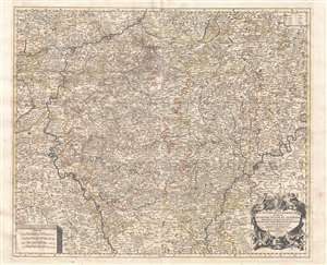
Le duché de Luxembourg divisé en quartier Wallon, et allemand dans chacun desquels sont diviséz les seigneuries, prevostés et comtés, le duché de Bouillon, le comté de Namur, etc.
$1,500.00
Acquire
- Digital Map Information
- Suitable for large format printing
- Full resolution TIFF file
- ICC color profile embedded
- Delivered instantly via download link
This is a large, impressive 1692 Alexis-Hubert Jaillot map of Luxembourg and parts of Belgium. Focused on the region between the Meuse and Moselle Rivers, the map depicts in minute detail from Rocroy in the west to Virnenbourg in the east and from Liege in the north to Thionville in the south. An elaborate allegorical cartouche appears in the lower right quadrant. Additional, less decorative, cartouches in the upper right and lower left feature a key and distance scale, respectively. Map names major and minor towns, rivers, counties, some topographical features, and political districts. (more details)
Magnificent Seventeenth-Century Asia.
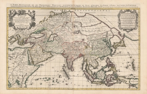
L'Asie diviseé en ses Principales Regions, et ou se peut voir l'estendue Des Empires, Monarchies, Royaumes et Estats qui partagent présentement L'Asie.
$1,500.00
Acquire
- Digital Map Information
- Suitable for large format printing
- DPI: 600
- File Size: 112.68 MB
- File Type: ZIP / TIFF
- ICC color profile embedded
- Delivered instantly via download link
This is a beautiful example of Hubert Jaillot's two-sheet map of Asia in its 1696 Mortier issue. While fundamentally based on Nicolas Sanson's mapping of the continent, the map has been updated to reflect advances in European knowledge of the Far East. Moreover, Jaillot's background as a sculptor has resulted in the artfully engraved cartouches which grace this work. (more details)
The earliest acquirable European mapping of Korea based on firsthand report.
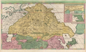
Carte Nouvelle de la Grande Tartarie.
$3,500.00
Acquire
- Digital Map Information
- Suitable for large format printing
- DPI: 600
- File Size: 123.4 MB
- File Type: ZIP / TIFF
- ICC color profile embedded
- Delivered instantly via download link
This is a stunning, original-color example of Pierre Mortier's 1696 two-sheet map of northern Asia, Siberia, and Tartary. It is drawn primarily from two sources: Hubert Jaillot's 1695 six-sheet wall map of Asia and Nicolaes Witsen's 1687 map of Tartary. As a result, this map represents the most up-to-date cartography of central and northeastern Asia of the seventeenth century, which would not be significantly improved upon until the maps of Strahlenberg thirty years later. (more details)
Among the Earliest Obtainable Maps of the Chesapeake.
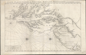
Carte Particuliere de Virginie, Maryland, Pennsilvanie, La Nouvelle Jarsey. Orient et Occidentale.
$4,500.00
Acquire
- Digital Map Information
- Suitable for large format printing
- Full resolution TIFF file
- ICC color profile embedded
- Delivered instantly via download link
This is Pierre Mortier and Alexis-Hubert Jaillot's c. 1700 large-format nautical chart of the Mid-Atlantic coast, including Chesapeake Bay and the Delaware River Estuary. One of the most important early modern maps of this region, it is significant for its early inclusion of Philadelphia and prodigious hydrographic information. (more details)
Large, Beautiful Map of the Kingdom of Naples.
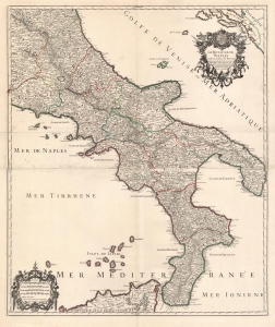
Le royaume de Naples divisé en toutes ses provinces...
$900.00
Acquire
- Digital Map Information
- Suitable for large format printing
- Full resolution TIFF file
- ICC color profile embedded
- Delivered instantly via download link
This is Hubert Jaillot's magnificent 1703/06 map of southern Italy, then dominated by the Kingdom of Naples. (more details)
Monumental twelve panel map of Paris.
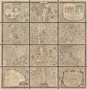
Plan De Paris, Levé Par Les Ordres Du Roy Et Par Les Soins De Messieurs Les Prevost Des Marchands Et Eschevins.
$3,000.00
Acquire
This majestic twelve panel map or plan of Paris is the c. 1900 Taride reissue of an important map originally prepared by Pierre Bullet, Francois Blonde, A. Bonnardt, and Bernard J. H. Jaillot. Like many early maps of Paris, the present example is oriented to the ... (more details)
Spectacular 18th century wall map published during the American Revolution.
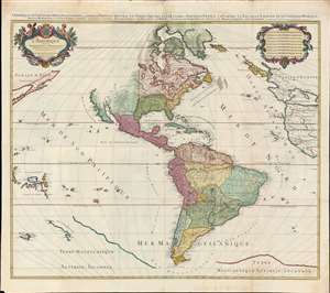
L'Amérique divisée en septentrionale et méridionale subdivisée en ses principales parties. / L'Amérique divisée en ses principales parties sçavoir dans la Septentrionale les Terres Arctiques, le Canada ou Nouvelle France, la Floride, la Nouvelle Espagne et le Nouveau Mexique ; dans la Méridionale la Terre Ferme, le Pérou, le Chili, la Terre Magellanique, le Paraguay, le Brésil. Les isles de Terre Neuve, Antilles, Magellaniques et de Californie.
$9,000.00
Acquire
- Digital Map Information
- Suitable for large format printing
- Full resolution TIFF file
- ICC color profile embedded
- Delivered instantly via download link
A spectacular 1782 wall map of North America and South America issued at the height of the American Revolutionary War, by Louis Charles Desnos, after Alexis-Hubert Jaillot. The map captures French ambitions to reclaim its American territories in the wake of the American Revolution. It also features the wealth of cartographic speculation of the era, including an unexplored Pacific Northwest and Arctic. The lower quadrants also reveal vestiges of the 16th century Terre Australis - the mythical southern continent disproven by Cook's first two voyages (His third voyage returned in 1880, but information about its discoveries had not yet been disseminated). (more details)