
Kitchell, William (sold)

William Kitchell (April 21, 1827 - December 29, 1861) was a geologist and cartographer active in New Jersey during the middle part of the 19th century. Kitchell was born in East Madison, Morris County, New Jersey. He briefly studied at Rutgers College before dropping out to study medicine at the University of New York. He later took a position teaching Natural Sciences at the Newark Institute. Around 1850, finding his calling in this field, Kitchell proceeded to Germany in order to pursue a degree at the Mining School of Freiberg. On his return, in 1854, he was appointed to the office of State Geologist of New Jersey with a commission to produce a geological survey and accompanying topographical map of the state. A failure in legislative appropriations led to the position of State Geologist being abolished in 1860. Kitchell successfully lobbied for a reinstatement of the position and in 1860 was giving permission to continue work, though at his own expense, on his topographical map and geological survey. Later that year Kitchell published his cardinal work, the Topographical Map of New Jersey, arguably the largest and most detailed map of New Jersey ever made. One year later, in 1861, Kitchell unexpectedly died of an unknown acute illness, leaving his assistant, George H. Cook, to continue the Geological Survey, which was finally published in 1868.
The largest and most detailed map of New Jersey to appear in the 19th century - a seminal production.
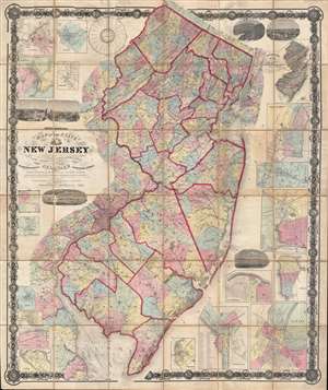
Topographical map of the State of New Jersey together with the vicinities of New York and Philadelphia, and with most of the state of Delaware from the State Geological Survey and the U.S. Coast Survey, and from surveys by G. Morgan Hopkins, civil engineer.
sold
- Digital Map Information
- Suitable for large format printing
- File Size: 166.59 MB
- File Type: ZIP / TIFF
- ICC color profile embedded
- Delivered instantly via download link
Magnificently detailed, visually stunning, and monumentally proportioned, this is William Kitchell's seminal 1860 case map of New Jersey. Dissected and mounted on thirty-six linen backed panels, this map covers the entire state of New Jersey as well as the ... (more details)
The largest and most detailed map of New Jersey to appear in the 19th century - a seminal production.
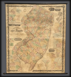
Topographical map of the State of New Jersey together with the vicinities of New York and Philadelphia, and with most of the state of Delaware from the State Geological Survey and the U.S. Coast Survey, and from surveys by G. Morgan Hopkins, civil engineer.
sold
Magnificently detailed, visually stunning, and monumentally proportioned, this is William Kitchell's seminal 1860 wall map of New Jersey. This is the largest map of New Jersey printedi n the 19th century. Mounted on linen with rollers, this map covers the ... (more details)