
Lake, Dunning Jackson (sold)

Dunning Jackson Lake (1836 - December 27, 1915) was a prominent civil engineer and map publisher based in Philadelphia in the second half of the 19th century. He was most born in Fairfield County, Connecticut, where he would have been a close associate of the prominent Beers mapmaking family - with whom he would later collaborate extensively. He began his mapmaking career by publishing special issue maps of Pennsylvania, Ohio, and Indiana between 1860 and 1870. In 1873 he turned his attention to atlas publishing, issuing more than 40 county atlases covering parts of Michigan, Indiana, Pennsylvania, Maryland (10 atlases), and Ohio. In 1875 he partnered with Bruce N. Griffing and 'Stevenson' to form the firm of 'Lake, Griffing, and Stevenson'. This firm published extensively until 1879, when it was dissolved. From 1879 Lake published as D. J. Lake and Co., issuing works on Kentucky, Indiana, and Illinois. He later relocated to California where he died in 1915.
Monumental map of Boston.
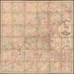
Map of the City of Boston and its Environs.
sold
- Digital Map Information
- Suitable for large format printing
- Full resolution TIFF file
- ICC color profile embedded
- Delivered instantly via download link
This is an 1867 Henry Francis Walling and Ormando W. Gray map of Boston, Massachusetts, and environs. Boston appears to the right of center, with East Boston and South Boston both labeled. Boston Common and the Public Garden are labeled in Boston, along with streets, wharves, railroad lines, and a handful of buildings. Outside Boston, the map depicts from Wilmington, Danvers, and North Beverly south to West Medway and Walpole Centre and from Ashland Center east to Marblehead, Salem, and Beverly. Hundreds (if not thousands) of private residences are identified by the owner's name throughout, along with banks, schools, railroad stations, churches, and cemeteries. Roads, railroads, hills, lakes, rivers, and other physical features are noted. (more details)