
Lasne, Jean-Etienne (sold)

Jean-Etienne Lasne (1596-1645) was a French engraver and illustrator; brother of the better-known and more prolific Michel Lasne (1594-1667), who became official engraver for King Louis XIII in 1633. The brothers were sons of a goldsmith. Two maps are known to bear Jean-Etienne's imprint: a 1628 plan of Rochelle, and a c. 1640 map of the region around Salses-le-Château depicting the 1639 siege. He appears mainly to have engraved illustrations and portraits; most of his known, signed output bears dates between 1622 and 1629.
Possibly one-of-a-kind map of a Siege Campaign in the Franco-Spanish War.
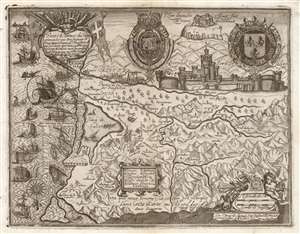
Entreé de l'Armee du Roy commandee par Monseigneur le Prince dans ala Comte de Roussllon...
sold
- Digital Map Information
- Suitable for large format printing
- DPI: 600
- File Size: 37.98 MB
- File Type: ZIP / TIFF
- ICC color profile embedded
- Delivered instantly via download link
This is a rare and highly evocative 1639 Jean-Etienne Lasne map of the region around Salses-le-Château, Roussillon, France, depicting its first siege during the Franco-Spanish War (1635 - 1659). The south-oriented map embraces the Province of Roussillon, including the Étang de Salces (Étang de Leucate), the cities of Salces, Leucate, and Perpignan, and other towns. (more details)